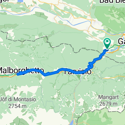
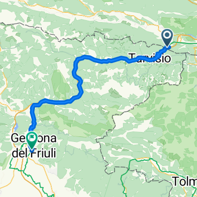
sLOVEnia
A cycling route starting in Hohenthurn, Carinthia, Austria.
Overview
About this route
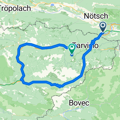
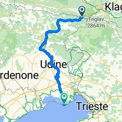
Thörl Maglern - Kranjska Gora - VRSIC - Bovec - Nova Gorica - Monfalcone - (EV 8) - Planina - Logatec - Ljubljana - Kranj - Bled - Wurzenpass - Arnoldstein
- -:--
- Duration
- 456.7 km
- Distance
- 8,412 m
- Ascent
- 8,414 m
- Descent
- ---
- Avg. speed
- 1,609 m
- Avg. speed
Route quality
Waytypes & surfaces along the route
Waytypes
Quiet road
164.8 km
(36 %)
Busy road
142.9 km
(31 %)
Surfaces
Paved
370.9 km
(81 %)
Unpaved
13.8 km
(3 %)
Asphalt
345.8 km
(76 %)
Paved (undefined)
24.2 km
(5 %)
Continue with Bikemap
Use, edit, or download this cycling route
You would like to ride sLOVEnia or customize it for your own trip? Here is what you can do with this Bikemap route:
Free features
- Save this route as favorite or in collections
- Copy & plan your own version of this route
- Sync your route with Garmin or Wahoo
Premium features
Free trial for 3 days, or one-time payment. More about Bikemap Premium.
- Navigate this route on iOS & Android
- Export a GPX / KML file of this route
- Create your custom printout (try it for free)
- Download this route for offline navigation
Discover more Premium features.
Get Bikemap PremiumFrom our community
Other popular routes starting in Hohenthurn
- sLOVEnia
- Distance
- 456.7 km
- Ascent
- 8,412 m
- Descent
- 8,414 m
- Location
- Hohenthurn, Carinthia, Austria
- Von Arnoldstein bis Jesenice
- Distance
- 48.3 km
- Ascent
- 979 m
- Descent
- 1,065 m
- Location
- Hohenthurn, Carinthia, Austria
- MTB-Trail: ThörlMaglernZoll-Pressendellach-Draschitz-Göriach-Achomitz-AchomitzerAlm-TRAIL-WW508-ArlecchinoTRAIL-Camporosso-Tarvisio-Coccau-ThörlMaglernZoll
- Distance
- 37.4 km
- Ascent
- 1,474 m
- Descent
- 1,470 m
- Location
- Hohenthurn, Carinthia, Austria
- Hohenthurn Radfahren
- Distance
- 97.3 km
- Ascent
- 1,262 m
- Descent
- 1,245 m
- Location
- Hohenthurn, Carinthia, Austria
- soca
- Distance
- 99.4 km
- Ascent
- 2,367 m
- Descent
- 2,353 m
- Location
- Hohenthurn, Carinthia, Austria
- MTB-Berg/Trail IMPORT: Bartolosattel-Achomitzer Alm
- Distance
- 39.6 km
- Ascent
- 1,185 m
- Descent
- 1,167 m
- Location
- Hohenthurn, Carinthia, Austria
- Tarvis Bled
- Distance
- 59.8 km
- Ascent
- 831 m
- Descent
- 1,011 m
- Location
- Hohenthurn, Carinthia, Austria
- Göriacheralm
- Distance
- 38.6 km
- Ascent
- 1,140 m
- Descent
- 1,139 m
- Location
- Hohenthurn, Carinthia, Austria
Open it in the app