

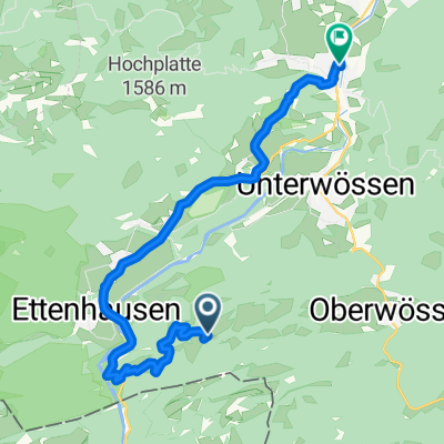
Gscheirerwand - Bäckeralm
A cycling route starting in Schleching, Bavaria, Germany.
Overview
About this route
-Schleching
-Gscheirer Wand
-Chiemhauser Alm (nur bei gutem Wetter -
Schlammloch vor Chiemhauser)
-Bäckeralm
-Schleching
- -:--
- Duration
- 17.1 km
- Distance
- 701 m
- Ascent
- 701 m
- Descent
- ---
- Avg. speed
- ---
- Max. altitude
Route highlights
Points of interest along the route
Point of interest after 5.5 km
Sehr schöne Aussicht über das Achental, auch über den Chiemsee (bei guter Sicht)
Point of interest after 10.7 km
Point of interest after 10.7 km
Chiemhauser Alm - sehr gute Einkehrmöglichkeit
Point of interest after 15.1 km
Achtung hier ist manchmal eine Schranke geschlossen! - Vorsicht bei rasanter Abfahrt
Continue with Bikemap
Use, edit, or download this cycling route
You would like to ride Gscheirerwand - Bäckeralm or customize it for your own trip? Here is what you can do with this Bikemap route:
Free features
- Save this route as favorite or in collections
- Copy & plan your own version of this route
- Sync your route with Garmin or Wahoo
Premium features
Free trial for 3 days, or one-time payment. More about Bikemap Premium.
- Navigate this route on iOS & Android
- Export a GPX / KML file of this route
- Create your custom printout (try it for free)
- Download this route for offline navigation
Discover more Premium features.
Get Bikemap PremiumFrom our community
Other popular routes starting in Schleching
 Parkplatz Taubensee Hinterwössen Kanonenpass
- Distance
- 41.1 km
- Ascent
- 1,665 m
- Descent
- 1,667 m
- Location
- Schleching, Bavaria, Germany
 Kampenwandstraße 7, Schleching do Kampenwandstraße 7, Schleching
- Distance
- 0.1 km
- Ascent
- 0 m
- Descent
- 0 m
- Location
- Schleching, Bavaria, Germany
 Route im Schneckentempo in Marquartstein
- Distance
- 17.3 km
- Ascent
- 156 m
- Descent
- 639 m
- Location
- Schleching, Bavaria, Germany
 Dalsenalm
- Distance
- 9.3 km
- Ascent
- 564 m
- Descent
- 567 m
- Location
- Schleching, Bavaria, Germany
 campingp. grasau
- Distance
- 23.4 km
- Ascent
- 276 m
- Descent
- 285 m
- Location
- Schleching, Bavaria, Germany
 Zellerseeweg 3, Schleching to Reit im Winkl
- Distance
- 22.2 km
- Ascent
- 1,114 m
- Descent
- 879 m
- Location
- Schleching, Bavaria, Germany
 Jochbergalm von Zellersee aus
- Distance
- 23.6 km
- Ascent
- 812 m
- Descent
- 812 m
- Location
- Schleching, Bavaria, Germany
 Südliche Kampenwandrunde mit Sonnen- und Oberauerbrunstalm
- Distance
- 22.6 km
- Ascent
- 1,256 m
- Descent
- 1,255 m
- Location
- Schleching, Bavaria, Germany
Open it in the app