

Hut to Hut -- With my boy :0)
A cycling route starting in Le Pizou, Nouvelle-Aquitaine, France.
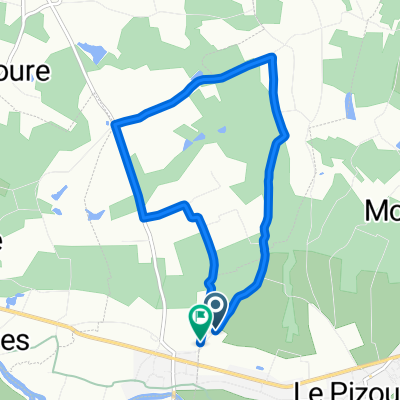
Overview
About this route
- -:--
- Duration
- 64.8 km
- Distance
- 517 m
- Ascent
- 456 m
- Descent
- ---
- Avg. speed
- ---
- Max. altitude
Route quality
Waytypes & surfaces along the route
Waytypes
Quiet road
42.1 km
(65 %)
Road
16.2 km
(25 %)
Surfaces
Paved
22.7 km
(35 %)
Asphalt
22.7 km
(35 %)
Undefined
42.1 km
(65 %)
Continue with Bikemap
Use, edit, or download this cycling route
You would like to ride Hut to Hut -- With my boy :0) or customize it for your own trip? Here is what you can do with this Bikemap route:
Free features
- Save this route as favorite or in collections
- Copy & plan your own version of this route
- Sync your route with Garmin or Wahoo
Premium features
Free trial for 3 days, or one-time payment. More about Bikemap Premium.
- Navigate this route on iOS & Android
- Export a GPX / KML file of this route
- Create your custom printout (try it for free)
- Download this route for offline navigation
Discover more Premium features.
Get Bikemap PremiumFrom our community
Other popular routes starting in Le Pizou
 De 1029A Chemin du Mange-Vent, Le Pizou à 1029A Chemin du Mange-Vent, Le Pizou
- Distance
- 18.1 km
- Ascent
- 168 m
- Descent
- 162 m
- Location
- Le Pizou, Nouvelle-Aquitaine, France
 Gurson Montaigne 3246m deniv 900m
- Distance
- 32.6 km
- Ascent
- 413 m
- Descent
- 396 m
- Location
- Le Pizou, Nouvelle-Aquitaine, France
 De Route de Ferrachat à Route de Ferrachat
- Distance
- 8.5 km
- Ascent
- 83 m
- Descent
- 127 m
- Location
- Le Pizou, Nouvelle-Aquitaine, France
 Route from campsite to Gite 2012
- Distance
- 254.3 km
- Ascent
- 644 m
- Descent
- 634 m
- Location
- Le Pizou, Nouvelle-Aquitaine, France
 Hut to Hut -- With my boy :0)
- Distance
- 64.8 km
- Ascent
- 517 m
- Descent
- 456 m
- Location
- Le Pizou, Nouvelle-Aquitaine, France
 Itinéraire facile en Le Pizou
- Distance
- 11.2 km
- Ascent
- 1,361 m
- Descent
- 1,345 m
- Location
- Le Pizou, Nouvelle-Aquitaine, France
 De 1029A Chemin du Mange-Vent, Le Pizou à 10 Rue de l'Isle, Moulin-Neuf
- Distance
- 9.6 km
- Ascent
- 22 m
- Descent
- 32 m
- Location
- Le Pizou, Nouvelle-Aquitaine, France
 Villefranche-de-Lonchat- Limeuil
- Distance
- 88.5 km
- Ascent
- 380 m
- Descent
- 397 m
- Location
- Le Pizou, Nouvelle-Aquitaine, France
Open it in the app