

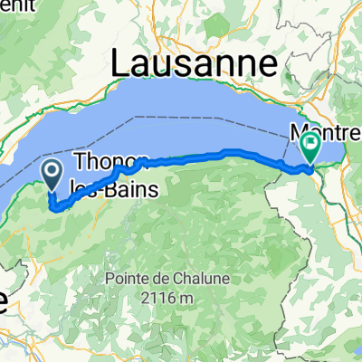
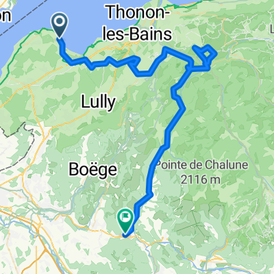
July 10th - Sciez or Bonneville to Annecy
A cycling route starting in Sciez, Auvergne-Rhône-Alpes, France.
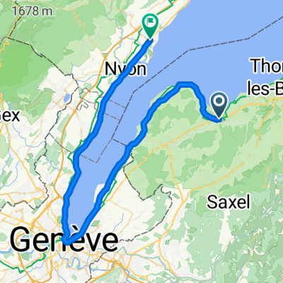
Overview
About this route
option to ride from hotel to Bonneville (50km) main ride starts from Bonneville and climbs to La Clusaz to Col D"aravis. Return down to Thones for lunch, then through to Annecy Hotel
- -:--
- Duration
- 123.7 km
- Distance
- 1,695 m
- Ascent
- 1,611 m
- Descent
- ---
- Avg. speed
- ---
- Max. altitude
Route quality
Waytypes & surfaces along the route
Waytypes
Quiet road
18.6 km
(15 %)
Track
4.9 km
(4 %)
Surfaces
Paved
91.5 km
(74 %)
Unpaved
3.7 km
(3 %)
Asphalt
90.3 km
(73 %)
Gravel
2.5 km
(2 %)
Continue with Bikemap
Use, edit, or download this cycling route
You would like to ride July 10th - Sciez or Bonneville to Annecy or customize it for your own trip? Here is what you can do with this Bikemap route:
Free features
- Save this route as favorite or in collections
- Copy & plan your own version of this route
- Split it into stages to create a multi-day tour
- Sync your route with Garmin or Wahoo
Premium features
Free trial for 3 days, or one-time payment. More about Bikemap Premium.
- Navigate this route on iOS & Android
- Export a GPX / KML file of this route
- Create your custom printout (try it for free)
- Download this route for offline navigation
Discover more Premium features.
Get Bikemap PremiumFrom our community
Other popular routes starting in Sciez
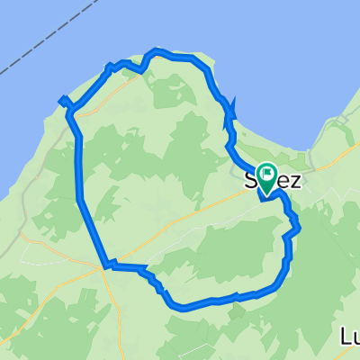
 June 12 Sciez, Col de Cou, Sciez
- Distance
- 60 km
- Ascent
- 978 m
- Descent
- 979 m
- Location
- Sciez, Auvergne-Rhône-Alpes, France
 From Excenevex to Port-Valais
- Distance
- 52.6 km
- Ascent
- 891 m
- Descent
- 905 m
- Location
- Sciez, Auvergne-Rhône-Alpes, France
 Tour du lac léman Aout 2014
- Distance
- 179.4 km
- Ascent
- 382 m
- Descent
- 381 m
- Location
- Sciez, Auvergne-Rhône-Alpes, France
 EXCENEVEX ALLINGES REYVROZ CHAMPEILLANT ST JEOIRE - 75 km 1600 m
- Distance
- 72.2 km
- Ascent
- 1,755 m
- Descent
- 1,564 m
- Location
- Sciez, Auvergne-Rhône-Alpes, France
 Excenevex to Prévessin-Moëns - e bike with baby carriage
- Distance
- 39.1 km
- Ascent
- 323 m
- Descent
- 278 m
- Location
- Sciez, Auvergne-Rhône-Alpes, France
 449 Chemin de Servettaz, Sciez à 449 Chemin de Servettaz, Sciez
- Distance
- 29.2 km
- Ascent
- 335 m
- Descent
- 337 m
- Location
- Sciez, Auvergne-Rhône-Alpes, France
 A1st June 2012 - Sciez, Yvoire Loop
- Distance
- 33.2 km
- Ascent
- 347 m
- Descent
- 350 m
- Location
- Sciez, Auvergne-Rhône-Alpes, France
 Sciez - Gland
- Distance
- 58.7 km
- Ascent
- 94 m
- Descent
- 106 m
- Location
- Sciez, Auvergne-Rhône-Alpes, France
Open it in the app