

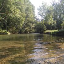
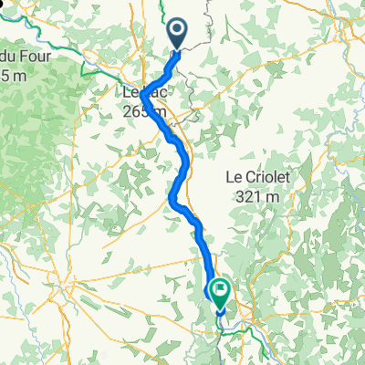
Chemin des Écorces, Châtillon-Coligny à 14 Grande Rue, Vimory
A cycling route starting in Châtillon-Coligny, Centre-Val de Loire, France.
Overview
About this route
- 1 h 17 min
- Duration
- 20.7 km
- Distance
- 60 m
- Ascent
- 96 m
- Descent
- 16 km/h
- Avg. speed
- 135 m
- Max. altitude
Route quality
Waytypes & surfaces along the route
Waytypes
Road
11.9 km
(58 %)
Busy road
4.9 km
(24 %)
Surfaces
Paved
2 km
(10 %)
Asphalt
1.8 km
(9 %)
Paved (undefined)
0.1 km
(<1 %)
Undefined
18.7 km
(90 %)
Continue with Bikemap
Use, edit, or download this cycling route
You would like to ride Chemin des Écorces, Châtillon-Coligny à 14 Grande Rue, Vimory or customize it for your own trip? Here is what you can do with this Bikemap route:
Free features
- Save this route as favorite or in collections
- Copy & plan your own version of this route
- Sync your route with Garmin or Wahoo
Premium features
Free trial for 3 days, or one-time payment. More about Bikemap Premium.
- Navigate this route on iOS & Android
- Export a GPX / KML file of this route
- Create your custom printout (try it for free)
- Download this route for offline navigation
Discover more Premium features.
Get Bikemap PremiumFrom our community
Other popular routes starting in Châtillon-Coligny
 Châtillon-Coligny, Cepoy
- Distance
- 33 km
- Ascent
- 100 m
- Descent
- 146 m
- Location
- Châtillon-Coligny, Centre-Val de Loire, France
 Canal de Briare 3
- Distance
- 22.8 km
- Ascent
- 55 m
- Descent
- 55 m
- Location
- Châtillon-Coligny, Centre-Val de Loire, France
 Canal de Briare 4
- Distance
- 24 km
- Ascent
- 112 m
- Descent
- 112 m
- Location
- Châtillon-Coligny, Centre-Val de Loire, France
 De Rue de Condé 17, Châtillon-Coligny à Rue de la Lancière 42, Sainte-Geneviève-des-Bois
- Distance
- 12.8 km
- Ascent
- 282 m
- Descent
- 334 m
- Location
- Châtillon-Coligny, Centre-Val de Loire, France
 Châtillon-Coligny - Fourchambault
- Distance
- 107.6 km
- Ascent
- 227 m
- Descent
- 201 m
- Location
- Châtillon-Coligny, Centre-Val de Loire, France
 Rue de la Lancière 50, Sainte-Geneviève-des-Bois to Place de la République 3, Briare
- Distance
- 40 km
- Ascent
- 219 m
- Descent
- 332 m
- Location
- Châtillon-Coligny, Centre-Val de Loire, France
 Tag 11 - BT - Chatillon-Coligny - Sully-sur-Loire
- Distance
- 70.2 km
- Ascent
- 322 m
- Descent
- 329 m
- Location
- Châtillon-Coligny, Centre-Val de Loire, France
 Chemin des Écorces, Châtillon-Coligny à 14 Grande Rue, Vimory
- Distance
- 20.7 km
- Ascent
- 60 m
- Descent
- 96 m
- Location
- Châtillon-Coligny, Centre-Val de Loire, France
Open it in the app