

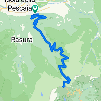
Poira di Civo
A cycling route starting in Morbegno, Lombardy, Italy.
Overview
About this route
Constant climb rich of fountains, hairpins and panorama over Adda river. Sometimes a narrow road crossing grapes cultivation, this is a very lonely and peaceful place. Sunny road, except last km with some shade and fresh winds.
- -:--
- Duration
- 11.5 km
- Distance
- 980 m
- Ascent
- 175 m
- Descent
- ---
- Avg. speed
- 1,079 m
- Max. altitude

Route quality
Waytypes & surfaces along the route
Waytypes
Quiet road
8 km
(70 %)
Road
3.4 km
(30 %)
Surfaces
Paved
11 km
(95 %)
Asphalt
11 km
(95 %)
Undefined
0.5 km
(5 %)
Continue with Bikemap
Use, edit, or download this cycling route
You would like to ride Poira di Civo or customize it for your own trip? Here is what you can do with this Bikemap route:
Free features
- Save this route as favorite or in collections
- Copy & plan your own version of this route
- Sync your route with Garmin or Wahoo
Premium features
Free trial for 3 days, or one-time payment. More about Bikemap Premium.
- Navigate this route on iOS & Android
- Export a GPX / KML file of this route
- Create your custom printout (try it for free)
- Download this route for offline navigation
Discover more Premium features.
Get Bikemap PremiumFrom our community
Other popular routes starting in Morbegno
 Passo San Marco
- Distance
- 52 km
- Ascent
- 2,192 m
- Descent
- 2,188 m
- Location
- Morbegno, Lombardy, Italy
 Tour of the Northern Alps 2018
- Distance
- 933 km
- Ascent
- 5,115 m
- Descent
- 5,115 m
- Location
- Morbegno, Lombardy, Italy
 Morbegno - Passo San Marco
- Distance
- 26 km
- Ascent
- 1,747 m
- Descent
- 33 m
- Location
- Morbegno, Lombardy, Italy
 Day 2 Morbegno to Stelvio allo Prato
- Distance
- 136.7 km
- Ascent
- 2,863 m
- Descent
- 1,819 m
- Location
- Morbegno, Lombardy, Italy
 From Morbegno to Alpe Ledino
- Distance
- 32.6 km
- Ascent
- 1,068 m
- Descent
- 1,072 m
- Location
- Morbegno, Lombardy, Italy
 Morbegno - Val Masino - Morbegno
- Distance
- 34.9 km
- Ascent
- 870 m
- Descent
- 870 m
- Location
- Morbegno, Lombardy, Italy
 Pso San Marco-Culmine San Pietro
- Distance
- 146.3 km
- Ascent
- 2,889 m
- Descent
- 2,900 m
- Location
- Morbegno, Lombardy, Italy
 Fail dal Africa
- Distance
- 52.3 km
- Ascent
- 1,871 m
- Descent
- 1,874 m
- Location
- Morbegno, Lombardy, Italy
Open it in the app