

Angyalos - Gidófalva - Kálnok - Sepsikőröspatak - Árkos
A cycling route starting in Sfântu Gheorghe, Covasna County, Romania.
Overview
About this route
- 2 h 26 min
- Duration
- 37 km
- Distance
- 243 m
- Ascent
- 243 m
- Descent
- 15.2 km/h
- Avg. speed
- 593 m
- Max. altitude

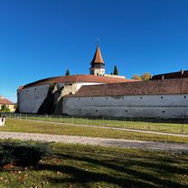
Route photos


Continue with Bikemap
Use, edit, or download this cycling route
You would like to ride Angyalos - Gidófalva - Kálnok - Sepsikőröspatak - Árkos or customize it for your own trip? Here is what you can do with this Bikemap route:
Free features
- Save this route as favorite or in collections
- Copy & plan your own version of this route
- Sync your route with Garmin or Wahoo
Premium features
Free trial for 3 days, or one-time payment. More about Bikemap Premium.
- Navigate this route on iOS & Android
- Export a GPX / KML file of this route
- Create your custom printout (try it for free)
- Download this route for offline navigation
Discover more Premium features.
Get Bikemap PremiumFrom our community
Other popular routes starting in Sfântu Gheorghe
 Traseu RACE Saint George MTB Maraton 2013
- Distance
- 52.9 km
- Ascent
- 1,088 m
- Descent
- 1,086 m
- Location
- Sfântu Gheorghe, Covasna County, Romania
 Bikfalva - Lisznyó - Sepsimagyarós - Uzon
- Distance
- 47.8 km
- Ascent
- 230 m
- Descent
- 230 m
- Location
- Sfântu Gheorghe, Covasna County, Romania
 Sfantu Gheorghe - Intorsura Buzaului si retur
- Distance
- 90.7 km
- Ascent
- 411 m
- Descent
- 411 m
- Location
- Sfântu Gheorghe, Covasna County, Romania
 Sugás
Sugás- Distance
- 8.1 km
- Ascent
- 306 m
- Descent
- 78 m
- Location
- Sfântu Gheorghe, Covasna County, Romania
 Prázsmár - Tatrang
- Distance
- 62.7 km
- Ascent
- 207 m
- Descent
- 207 m
- Location
- Sfântu Gheorghe, Covasna County, Romania
 Szaszfold 2
- Distance
- 299.1 km
- Ascent
- 1,120 m
- Descent
- 1,232 m
- Location
- Sfântu Gheorghe, Covasna County, Romania
 Angyalos - Gidófalva - Kálnok - Sepsikőröspatak - Árkos
- Distance
- 37 km
- Ascent
- 243 m
- Descent
- 243 m
- Location
- Sfântu Gheorghe, Covasna County, Romania
 Prezentarea traseului scurt SGMTBM 2012
- Distance
- 33.1 km
- Ascent
- 628 m
- Descent
- 627 m
- Location
- Sfântu Gheorghe, Covasna County, Romania
Open it in the app