

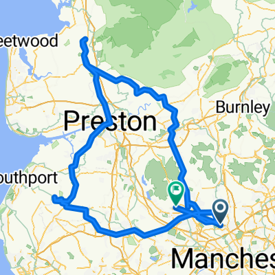
Radcliffe- Burscough-Garstang-Radcliffe
A cycling route starting in Radcliffe, England, United Kingdom.
Overview
About this route
- -:--
- Duration
- 183.5 km
- Distance
- 722 m
- Ascent
- 635 m
- Descent
- ---
- Avg. speed
- ---
- Max. altitude
Route highlights
Points of interest along the route
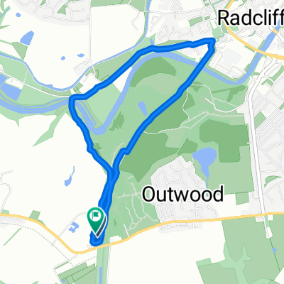
Point of interest after 55.5 km
Day 1
Point of interest after 100.5 km
Day 2
Continue with Bikemap
Use, edit, or download this cycling route
You would like to ride Radcliffe- Burscough-Garstang-Radcliffe or customize it for your own trip? Here is what you can do with this Bikemap route:
Free features
- Save this route as favorite or in collections
- Copy & plan your own version of this route
- Split it into stages to create a multi-day tour
- Sync your route with Garmin or Wahoo
Premium features
Free trial for 3 days, or one-time payment. More about Bikemap Premium.
- Navigate this route on iOS & Android
- Export a GPX / KML file of this route
- Create your custom printout (try it for free)
- Download this route for offline navigation
Discover more Premium features.
Get Bikemap PremiumFrom our community
Other popular routes starting in Radcliffe
 Radcliffe- Burscough-Garstang-Radcliffe
- Distance
- 183.5 km
- Ascent
- 722 m
- Descent
- 635 m
- Location
- Radcliffe, England, United Kingdom
 Hollybank Street, Radcliffe to Chatsworth Grove 27, Little Lever
- Distance
- 4 km
- Ascent
- 0 m
- Descent
- 0 m
- Location
- Radcliffe, England, United Kingdom
 canal
canal- Distance
- 5.4 km
- Ascent
- 12 m
- Descent
- 16 m
- Location
- Radcliffe, England, United Kingdom
 Larch Avenue 2, Radcliffe to Larch Avenue 2, Radcliffe
- Distance
- 24.2 km
- Ascent
- 326 m
- Descent
- 324 m
- Location
- Radcliffe, England, United Kingdom
 ELTON RESERVOIR
- Distance
- 21.4 km
- Ascent
- 164 m
- Descent
- 163 m
- Location
- Radcliffe, England, United Kingdom
 Radcliffe to Garstang and back
- Distance
- 156.1 km
- Ascent
- 1,054 m
- Descent
- 1,057 m
- Location
- Radcliffe, England, United Kingdom
 Radcliffe to Burnley inc Littleborough
- Distance
- 78.8 km
- Ascent
- 558 m
- Descent
- 556 m
- Location
- Radcliffe, England, United Kingdom
 Steady Monday Ride Asda bridge
- Distance
- 3.8 km
- Ascent
- 45 m
- Descent
- 32 m
- Location
- Radcliffe, England, United Kingdom
Open it in the app