

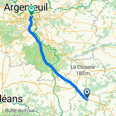
ESS 21/09/2024 SURY AUX BOIS
A cycling route starting in Aillant-sur-Tholon, Bourgogne-Franche-Comté, France.
Overview
About this route
- 7 h 34 min
- Duration
- 122.3 km
- Distance
- 514 m
- Ascent
- 532 m
- Descent
- 16.2 km/h
- Avg. speed
- 228 m
- Max. altitude

Route quality
Waytypes & surfaces along the route
Waytypes
Road
39.6 km
(32 %)
Quiet road
37.5 km
(31 %)
Surfaces
Paved
66.4 km
(54 %)
Unpaved
2.1 km
(2 %)
Asphalt
65 km
(53 %)
Gravel
2.1 km
(2 %)
Continue with Bikemap
Use, edit, or download this cycling route
You would like to ride ESS 21/09/2024 SURY AUX BOIS or customize it for your own trip? Here is what you can do with this Bikemap route:
Free features
- Save this route as favorite or in collections
- Copy & plan your own version of this route
- Split it into stages to create a multi-day tour
- Sync your route with Garmin or Wahoo
Premium features
Free trial for 3 days, or one-time payment. More about Bikemap Premium.
- Navigate this route on iOS & Android
- Export a GPX / KML file of this route
- Create your custom printout (try it for free)
- Download this route for offline navigation
Discover more Premium features.
Get Bikemap PremiumFrom our community
Other popular routes starting in Aillant-sur-Tholon
 Aillant-sur-Tholon - Paris
- Distance
- 139.5 km
- Ascent
- 186 m
- Descent
- 277 m
- Location
- Aillant-sur-Tholon, Bourgogne-Franche-Comté, France
 day 2 fountainbleau to sommercaise
- Distance
- 80.7 km
- Ascent
- 245 m
- Descent
- 378 m
- Location
- Aillant-sur-Tholon, Bourgogne-Franche-Comté, France
 Place de la Mairie, La Ferté-Loupière à 31 Route de la Mothe, Charny
- Distance
- 16 km
- Ascent
- 122 m
- Descent
- 115 m
- Location
- Aillant-sur-Tholon, Bourgogne-Franche-Comté, France
 141 Villiers-sur-Tholon, Montholon à 4 Ruelle des Concises Legouge, Montholon
- Distance
- 29.4 km
- Ascent
- 140 m
- Descent
- 142 m
- Location
- Aillant-sur-Tholon, Bourgogne-Franche-Comté, France
 ESS 21/09/2024 SURY AUX BOIS
- Distance
- 122.3 km
- Ascent
- 514 m
- Descent
- 532 m
- Location
- Aillant-sur-Tholon, Bourgogne-Franche-Comté, France
 3 Ruelle des Concises Legouge, Montholon à 4 Ruelle des Concises Legouge, Montholon
- Distance
- 12.3 km
- Ascent
- 46 m
- Descent
- 47 m
- Location
- Aillant-sur-Tholon, Bourgogne-Franche-Comté, France
 pa ni 2
- Distance
- 37.7 km
- Ascent
- 429 m
- Descent
- 413 m
- Location
- Aillant-sur-Tholon, Bourgogne-Franche-Comté, France
 3 Ruelle des Concises Legouge, Montholon à 141 Villiers-sur-Tholon, Montholon
- Distance
- 21.3 km
- Ascent
- 92 m
- Descent
- 92 m
- Location
- Aillant-sur-Tholon, Bourgogne-Franche-Comté, France
Open it in the app