
Kolesarski vzpon sindikat reševalcev
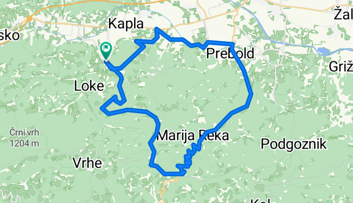
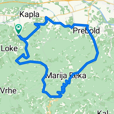
A cycling route starting in Tabor, Tabor, Slovenia.
Overview
About this route
- -:--
- Duration
- 30.6 km
- Distance
- 980 m
- Ascent
- 978 m
- Descent
- ---
- Avg. speed
- 796 m
- Max. altitude
Tomaž Horvat
created this 1 year ago
Route quality
Waytypes & surfaces along the route
Waytypes
Quiet road
15.6 km
(51 %)
Access road
2.1 km
(7 %)
Surfaces
Paved
23.8 km
(78 %)
Asphalt
22.3 km
(73 %)
Paved (undefined)
1.5 km
(5 %)
Undefined
6.7 km
(22 %)
Continue with Bikemap
Use, edit, or download this cycling route
You would like to ride Kolesarski vzpon sindikat reševalcev or customize it for your own trip? Here is what you can do with this Bikemap route:
Free features
- Save this route as favorite or in collections
- Copy & plan your own version of this route
- Sync your route with Garmin or Wahoo
Premium features
Free trial for 3 days, or one-time payment. More about Bikemap Premium.
- Navigate this route on iOS & Android
- Export a GPX / KML file of this route
- Create your custom printout (try it for free)
- Download this route for offline navigation
Discover more Premium features.
Get Bikemap PremiumFrom our community
Other popular routes starting in Tabor
- Kolesarski vzpon sindikat reševalcev
- 30.6 km
- 980 m
- 978 m
- Tabor, Tabor, Slovenia
- od doma - Črni Vrh - Čeplje - Domov
- 25.3 km
- 399 m
- 397 m
- Tabor, Tabor, Slovenia
- Prebold
- 12.9 km
- 30 m
- 34 m
- Tabor, Tabor, Slovenia
- čez hrib v Letuš
- 34.1 km
- 211 m
- 211 m
- Tabor, Tabor, Slovenia
- Čemšeniška planina - MTB
- 28.2 km
- 1,340 m
- 1,387 m
- Tabor, Tabor, Slovenia
- Gomilsko in Marija Reka
- 40.5 km
- 1,668 m
- 1,668 m
- Tabor, Tabor, Slovenia
- Tabor-Vrhe_Marija reka-Prebold_Tabor
- 48 km
- 802 m
- 801 m
- Tabor, Tabor, Slovenia


Open it in the app