

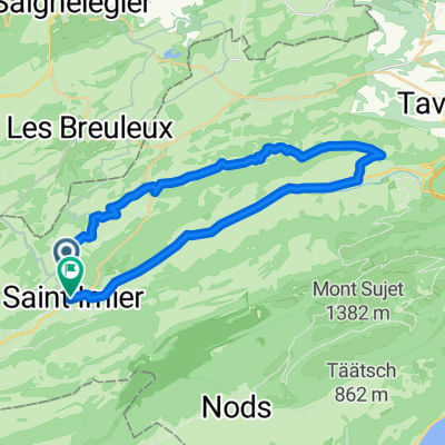
Chasseral - Le Landeron par Les Colisses, Nods et Lignières
A cycling route starting in Saint-Imier, Canton of Bern, Switzerland.
Overview
About this route
- -:--
- Duration
- 26.1 km
- Distance
- 86 m
- Ascent
- 1,198 m
- Descent
- ---
- Avg. speed
- ---
- Max. altitude
Route quality
Waytypes & surfaces along the route
Waytypes
Track
10.7 km
(41 %)
Access road
6.3 km
(24 %)
Surfaces
Paved
11 km
(42 %)
Unpaved
11.5 km
(44 %)
Gravel
9.4 km
(36 %)
Asphalt
7.8 km
(30 %)
Route highlights
Points of interest along the route
Point of interest after 12 km
Continue with Bikemap
Use, edit, or download this cycling route
You would like to ride Chasseral - Le Landeron par Les Colisses, Nods et Lignières or customize it for your own trip? Here is what you can do with this Bikemap route:
Free features
- Save this route as favorite or in collections
- Copy & plan your own version of this route
- Sync your route with Garmin or Wahoo
Premium features
Free trial for 3 days, or one-time payment. More about Bikemap Premium.
- Navigate this route on iOS & Android
- Export a GPX / KML file of this route
- Create your custom printout (try it for free)
- Download this route for offline navigation
Discover more Premium features.
Get Bikemap PremiumFrom our community
Other popular routes starting in Saint-Imier
 Chasseral - Frinvillier
- Distance
- 18.5 km
- Ascent
- 141 m
- Descent
- 1,157 m
- Location
- Saint-Imier, Canton of Bern, Switzerland
 Mont_Soleil
- Distance
- 32.2 km
- Ascent
- 337 m
- Descent
- 798 m
- Location
- Saint-Imier, Canton of Bern, Switzerland
 Rue Principale 30, Villeret nach Rue Principale 30, Villeret
- Distance
- 39.1 km
- Ascent
- 1,039 m
- Descent
- 1,571 m
- Location
- Saint-Imier, Canton of Bern, Switzerland
 Tete de Ran
- Distance
- 52.8 km
- Ascent
- 1,251 m
- Descent
- 1,368 m
- Location
- Saint-Imier, Canton of Bern, Switzerland
 Mont-Soleil, Saint-Imier nach Stade de la Courtine 3, Corgémont
- Distance
- 38.4 km
- Ascent
- 251 m
- Descent
- 854 m
- Location
- Saint-Imier, Canton of Bern, Switzerland
 Itinéraire confortable en St-Imier
- Distance
- 19.2 km
- Ascent
- 686 m
- Descent
- 686 m
- Location
- Saint-Imier, Canton of Bern, Switzerland
 Chasseral - Wolhusen
- Distance
- 167 km
- Ascent
- 1,342 m
- Descent
- 2,274 m
- Location
- Saint-Imier, Canton of Bern, Switzerland
 Chasseral I
- Distance
- 49.5 km
- Ascent
- 1,596 m
- Descent
- 1,578 m
- Location
- Saint-Imier, Canton of Bern, Switzerland
Open it in the app