

2005 (Excursión - Villaviciosa)
A cycling route starting in Villaviciosa, Principality of Asturias, Spain.
Overview
About this route
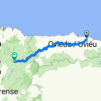
No. 1 - Villaviciosa - Lastres - Colunga - Pto. del Fito - Arriondas - Infiesto - Villaviciosa.
1st Pto. del Fito
- -:--
- Duration
- 87.5 km
- Distance
- 1,099 m
- Ascent
- 1,096 m
- Descent
- ---
- Avg. speed
- ---
- Max. altitude

Route highlights
Points of interest along the route
Point of interest after 10.6 km
Cumbre:
Point of interest after 35.1 km
Pto. del Fito
Point of interest after 35.7 km
Avituallamiento:
Point of interest after 75 km
Cumbre:
Accommodation after 87 km
Hotel : Cristal.
Continue with Bikemap
Use, edit, or download this cycling route
You would like to ride 2005 (Excursión - Villaviciosa) or customize it for your own trip? Here is what you can do with this Bikemap route:
Free features
- Save this route as favorite or in collections
- Copy & plan your own version of this route
- Split it into stages to create a multi-day tour
- Sync your route with Garmin or Wahoo
Premium features
Free trial for 3 days, or one-time payment. More about Bikemap Premium.
- Navigate this route on iOS & Android
- Export a GPX / KML file of this route
- Create your custom printout (try it for free)
- Download this route for offline navigation
Discover more Premium features.
Get Bikemap PremiumFrom our community
Other popular routes starting in Villaviciosa
 Camino Primitivo Fra kysten til Lugo
- Distance
- 270 km
- Ascent
- 2,891 m
- Descent
- 2,492 m
- Location
- Villaviciosa, Principality of Asturias, Spain
 Villaviciosa
- Distance
- 85.2 km
- Ascent
- 1,054 m
- Descent
- 1,052 m
- Location
- Villaviciosa, Principality of Asturias, Spain
 Villaviciosa - Cabranes - Altu La Llama - Colunga - Llastres - Villaviciosa
- Distance
- 66.9 km
- Ascent
- 803 m
- Descent
- 802 m
- Location
- Villaviciosa, Principality of Asturias, Spain
 Valdediós y Bozanes
- Distance
- 20 km
- Ascent
- 238 m
- Descent
- 240 m
- Location
- Villaviciosa, Principality of Asturias, Spain
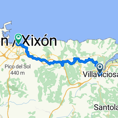 Villaviciosa - Gijón
- Distance
- 33 km
- Ascent
- 1,004 m
- Descent
- 988 m
- Location
- Villaviciosa, Principality of Asturias, Spain
 2005 (Excursión - Villaviciosa)
- Distance
- 87.5 km
- Ascent
- 1,099 m
- Descent
- 1,096 m
- Location
- Villaviciosa, Principality of Asturias, Spain
 El Puntal
- Distance
- 15.3 km
- Ascent
- 42 m
- Descent
- 42 m
- Location
- Villaviciosa, Principality of Asturias, Spain
 Selorio-Lastres-Colunga
- Distance
- 25.2 km
- Ascent
- 494 m
- Descent
- 370 m
- Location
- Villaviciosa, Principality of Asturias, Spain
Open it in the app