
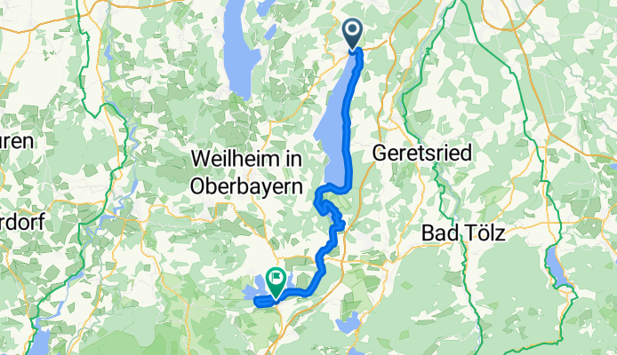
Starnberg - Murnau
A cycling route starting in Starnberg, Bavaria, Germany.
Overview
About this route
- -:--
- Duration
- 63.1 km
- Distance
- 735 m
- Ascent
- 644 m
- Descent
- ---
- Avg. speed
- 729 m
- Avg. speed
Route quality
Waytypes & surfaces along the route
Waytypes
Quiet road
29.6 km
(47 %)
Track
11 km
(17 %)
Surfaces
Paved
47.9 km
(76 %)
Unpaved
12.5 km
(20 %)
Asphalt
46.1 km
(73 %)
Gravel
10 km
(16 %)
Continue with Bikemap
Use, edit, or download this cycling route
You would like to ride Starnberg - Murnau or customize it for your own trip? Here is what you can do with this Bikemap route:
Free features
- Save this route as favorite or in collections
- Copy & plan your own version of this route
- Sync your route with Garmin or Wahoo
Premium features
Free trial for 3 days, or one-time payment. More about Bikemap Premium.
- Navigate this route on iOS & Android
- Export a GPX / KML file of this route
- Create your custom printout (try it for free)
- Download this route for offline navigation
Discover more Premium features.
Get Bikemap PremiumFrom our community
Other popular routes starting in Starnberg
 Starnberg-Dachau 2023-07-13 19:44:21
- Distance
- 51.2 km
- Ascent
- 178 m
- Descent
- 285 m
- Location
- Starnberg, Bavaria, Germany
 Starnberg-Rund um den See
- Distance
- 70.1 km
- Ascent
- 834 m
- Descent
- 831 m
- Location
- Starnberg, Bavaria, Germany
 Am Ufer des Starnberger Sees
- Distance
- 52 km
- Ascent
- 260 m
- Descent
- 251 m
- Location
- Starnberg, Bavaria, Germany
 Starnberger See Teil 2
- Distance
- 26 km
- Ascent
- 205 m
- Descent
- 191 m
- Location
- Starnberg, Bavaria, Germany
 Starnberg - Starnberger See Umrundung
- Distance
- 52.7 km
- Ascent
- 106 m
- Descent
- 108 m
- Location
- Starnberg, Bavaria, Germany
 STA-Leutstetten-Wangen-STA
- Distance
- 15 km
- Ascent
- 172 m
- Descent
- 169 m
- Location
- Starnberg, Bavaria, Germany
 Starnberger See umrunden
- Distance
- 53 km
- Ascent
- 365 m
- Descent
- 311 m
- Location
- Starnberg, Bavaria, Germany
 Lena sta larn
- Distance
- 12.4 km
- Ascent
- 167 m
- Descent
- 144 m
- Location
- Starnberg, Bavaria, Germany
Open it in the app