

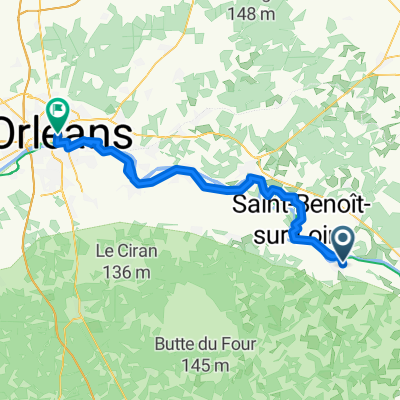
Loire by bike - Sully-sur-Loire to Angers
A cycling route starting in Sully-sur-Loire, Centre-Val de Loire, France.
Overview
About this route
More about Loire by bike:
https://www.cyclingthread.com/cycling-loire-valley-loire-velo-castles-and-wine
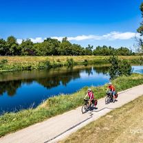
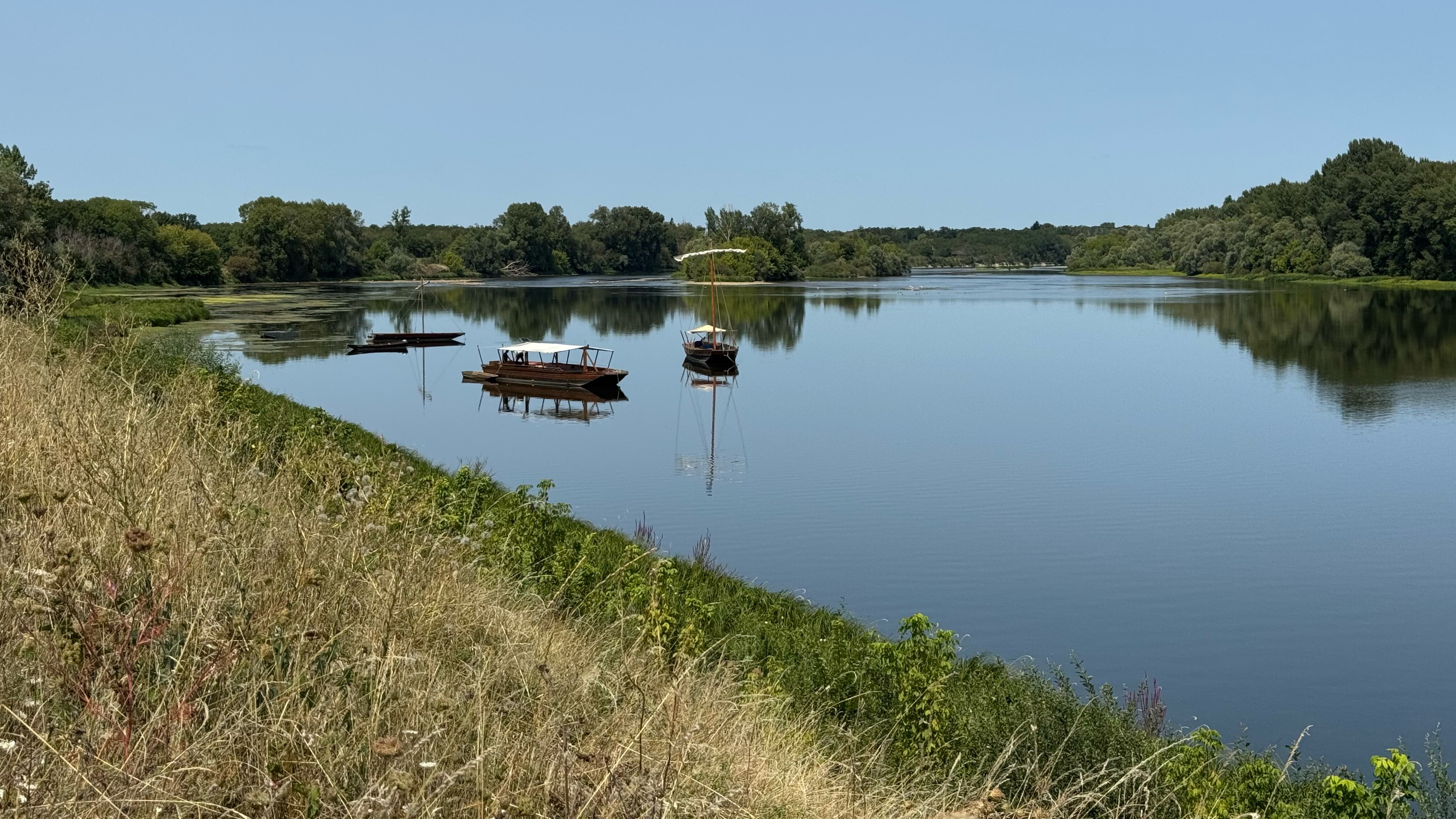
The Loire à Vélo route in the Loire Valley is mostly on gravel paths instead of smooth asphalt, which makes the cycling different than many imagine. The river views are calm and modest, but the many castles and palaces quickly become the main attraction. The route passes through a region full of history, culture and architecture that give the ride extra depth. Riders see famous châteaux with different styles and stories, surrounded by the gentle scenery of the Loire. The area is well prepared for cycling tourism with clear signs, cyclist friendly services and even trains adapted for bikes. Along the way there are historic towns, gardens and vineyards that add variety to the journey. It is a route that combines cycling with an immersive experience of the Loire Valley’s heritage.
- -:--
- Duration
- 382.1 km
- Distance
- 1,990 m
- Ascent
- 2,064 m
- Descent
- ---
- Avg. speed
- 122 m
- Max. altitude

Route photos


Route quality
Waytypes & surfaces along the route
Waytypes
Quiet road
153.1 km
(40 %)
Cycleway
60.1 km
(16 %)
Surfaces
Paved
214 km
(56 %)
Unpaved
36.6 km
(10 %)
Asphalt
188.9 km
(49 %)
Gravel
28.7 km
(8 %)
Continue with Bikemap
Use, edit, or download this cycling route
You would like to ride Loire by bike - Sully-sur-Loire to Angers or customize it for your own trip? Here is what you can do with this Bikemap route:
Free features
- Save this route as favorite or in collections
- Copy & plan your own version of this route
- Split it into stages to create a multi-day tour
- Sync your route with Garmin or Wahoo
Premium features
Free trial for 3 days, or one-time payment. More about Bikemap Premium.
- Navigate this route on iOS & Android
- Export a GPX / KML file of this route
- Create your custom printout (try it for free)
- Download this route for offline navigation
Discover more Premium features.
Get Bikemap PremiumFrom our community
Other popular routes starting in Sully-sur-Loire
 Loire by bike - Sully-sur-Loire to Angers
- Distance
- 382.1 km
- Ascent
- 1,990 m
- Descent
- 2,064 m
- Location
- Sully-sur-Loire, Centre-Val de Loire, France
 LV15 Sully to Orleans.kml - LV15 Sully to Orleans.kml_LV15 Sully to Orleans
- Distance
- 50.9 km
- Ascent
- 121 m
- Descent
- 144 m
- Location
- Sully-sur-Loire, Centre-Val de Loire, France
 F 14 Sully-sur-Loire - Orléans
- Distance
- 78.3 km
- Ascent
- 175 m
- Descent
- 173 m
- Location
- Sully-sur-Loire, Centre-Val de Loire, France
 Sully - Chateneuf
- Distance
- 10.7 km
- Ascent
- 21 m
- Descent
- 26 m
- Location
- Sully-sur-Loire, Centre-Val de Loire, France
 Chemin de la Salle Verte, Sully-sur-Loire à Saint-Jean-le-Blanc
- Distance
- 47 km
- Ascent
- 19 m
- Descent
- 36 m
- Location
- Sully-sur-Loire, Centre-Val de Loire, France
 04 - Sully sur Loire - Orléans
- Distance
- 53 km
- Ascent
- 82 m
- Descent
- 88 m
- Location
- Sully-sur-Loire, Centre-Val de Loire, France
 Sully to Orleans
- Distance
- 50.1 km
- Ascent
- 163 m
- Descent
- 162 m
- Location
- Sully-sur-Loire, Centre-Val de Loire, France
 Sully_Decize
- Distance
- 196.3 km
- Ascent
- 594 m
- Descent
- 521 m
- Location
- Sully-sur-Loire, Centre-Val de Loire, France
Open it in the app