

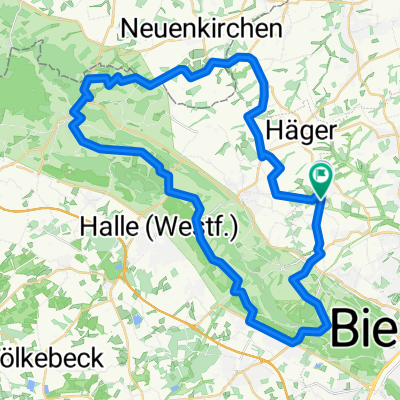
Frühlingsrunde am 31.3.2009
A cycling route starting in Werther, North Rhine-Westphalia, Germany.
Overview
About this route
Finally the sun is out and it is fun to cycle again in the Ravensberger Hügelland and enjoy the beautiful landscapes.
Easy tour to warm up, which mostly runs on small roads through small villages. From the starting point in Deppendorf, it goes through Häger, Bardüttingdorf, Mantershagen, Wallenbrück, Riemsloh, Ostenfelde, Neuenkirchen, Theenhausen, and Rotenhagen back to Deppendorf.
Reinhard 31.03.2009
- -:--
- Duration
- 44.5 km
- Distance
- 255 m
- Ascent
- 245 m
- Descent
- ---
- Avg. speed
- 154 m
- Max. altitude
Route quality
Waytypes & surfaces along the route
Waytypes
Quiet road
24.9 km
(56 %)
Path
5.8 km
(13 %)
Surfaces
Paved
21.3 km
(48 %)
Unpaved
2.2 km
(5 %)
Asphalt
20.5 km
(46 %)
Paved (undefined)
0.9 km
(2 %)
Continue with Bikemap
Use, edit, or download this cycling route
You would like to ride Frühlingsrunde am 31.3.2009 or customize it for your own trip? Here is what you can do with this Bikemap route:
Free features
- Save this route as favorite or in collections
- Copy & plan your own version of this route
- Sync your route with Garmin or Wahoo
Premium features
Free trial for 3 days, or one-time payment. More about Bikemap Premium.
- Navigate this route on iOS & Android
- Export a GPX / KML file of this route
- Create your custom printout (try it for free)
- Download this route for offline navigation
Discover more Premium features.
Get Bikemap PremiumFrom our community
Other popular routes starting in Werther
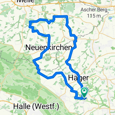
 Werther Eisdiele Über Häger
- Distance
- 17.8 km
- Ascent
- 164 m
- Descent
- 174 m
- Location
- Werther, North Rhine-Westphalia, Germany
 Berg- und Talfahrt im Teutoburger Wald
- Distance
- 46.7 km
- Ascent
- 615 m
- Descent
- 610 m
- Location
- Werther, North Rhine-Westphalia, Germany
 Ullis Hausroute
- Distance
- 20.9 km
- Ascent
- 151 m
- Descent
- 164 m
- Location
- Werther, North Rhine-Westphalia, Germany
 Ascheloh-bRothenfelde-uz 42km
- Distance
- 42 km
- Ascent
- 239 m
- Descent
- 230 m
- Location
- Werther, North Rhine-Westphalia, Germany
 JANKS, von Kröger zum Tierpark
- Distance
- 6.9 km
- Ascent
- 89 m
- Descent
- 88 m
- Location
- Werther, North Rhine-Westphalia, Germany
 Trainingsstrecke im Ravensberger Hügelland
- Distance
- 49.2 km
- Ascent
- 493 m
- Descent
- 478 m
- Location
- Werther, North Rhine-Westphalia, Germany
 Bielefeld-Münster-Bielefeld 05.07.2009 CLONED FROM ROUTE 234653
- Distance
- 158.6 km
- Ascent
- 282 m
- Descent
- 286 m
- Location
- Werther, North Rhine-Westphalia, Germany
 Frühlingsrunde am 31.3.2009
- Distance
- 44.5 km
- Ascent
- 255 m
- Descent
- 245 m
- Location
- Werther, North Rhine-Westphalia, Germany
Open it in the app