Tende-Eze-Valbonne-Port Grimaud-Cannes 2017
- 317.7 km
- 1,757 m
- 2,577 m
- Tende, Provence-Alpes-Côte d'Azur Region, France
A cycling route starting in Tende, Provence-Alpes-Côte d'Azur Region, France.
Overview
ITINERARY DESCRIPTION
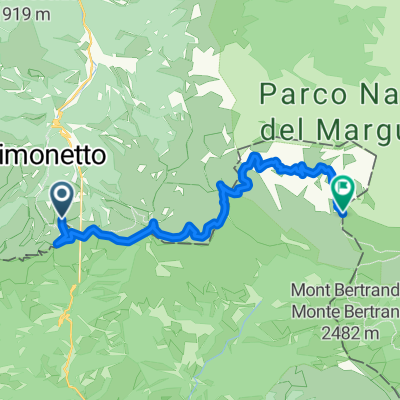
The Alta Via del Sale is an ancient and spectacular high-altitude route connecting Piedmont, Liguria, and France. The section between Limone Piemonte and Monesi is a beautiful itinerary that runs between 1800 and 2100 meters elevation on an old military road along the alpine watershed on the Italian-French border. We traveled the central stretch between Colle di Tenda and the Don Barbera refuge. Since the dirt road is a classic for motorized off-road enthusiasts across Europe, if you want to appreciate the wild and untouched beauty of the places crossed, we recommend doing it on days when traffic is closed (Tuesday and Thursday).
The route starts at Colle di Tenda where it's possible to visit the old military forts - Forte Alto, Forte Centrale, and barracks - then you take a dirt road with good surface and after a couple of kilometers the first climb begins. With gradients around 10%, you pass the arrival stations of the ski lifts, the toll gate for motorized vehicles, and a couple of hairpin bends. After passing Colle Campanino at 2140 m, you ride a panoramic traverse with a slight descent on the Piedmont side. Another 1 km ramp leads to the most spectacular section with the road carved into the rock and a steep hairpin turn. After passing Colle della Boaria at 2100 m, you enter French territory. Then you continue through the vast and desolate environment at the foot of Marguareis. The surface is always good except for a section around kilometer 15 that is a bit loose and rocky. Finally, you reach the Don Barbera refuge. The return on the same road still offers different panoramas.
created this 1 year ago
Route quality
Track
14.5 km
(85 %)
Path
1.5 km
(9 %)
Paved
0.9 km
(5 %)
Unpaved
14.3 km
(84 %)
Gravel
13.1 km
(77 %)
Ground
1 km
(6 %)
Continue with Bikemap
You would like to ride Limone - rifugio Barbera or customize it for your own trip? Here is what you can do with this Bikemap route:
Free trial for 3 days, or one-time payment. More about Bikemap Premium.
Discover more Premium features.
Get Bikemap PremiumFrom our community
Open it in the app