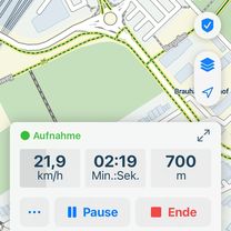

RTC Köln RTF 2008 150 Km
- 141.4 km
- 1,030 m
- 1,036 m
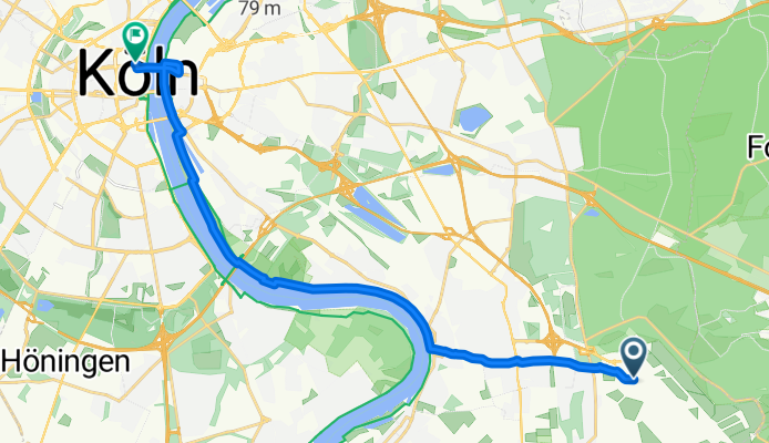
- Wahn-Heide, North Rhine-Westphalia, Germany
A cycling route starting in Wahn-Heide, North Rhine-Westphalia, Germany.
Overview
From Koln-Bonn Airport to Cologne Railway Station.
created this 13 years ago
Route quality
Path
7.6 km
(45 %)
Pedestrian area
4.2 km
(25 %)
Paved
12.6 km
(75 %)
Unpaved
0.2 km
(1 %)
Asphalt
12 km
(71 %)
Metal
0.3 km
(2 %)
Route highlights
Join the Rhine Route at this point
Continue with Bikemap
You would like to ride CYCLING THE RHINE: Route Approach F or customize it for your own trip? Here is what you can do with this Bikemap route:
Free trial for 3 days, or one-time payment. More about Bikemap Premium.
Discover more Premium features.
Get Bikemap PremiumFrom our community
Open it in the app