

Arlington 12 mi hill climb
A cycling route starting in Arlington, Texas, United States.
Overview
About this route
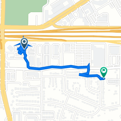
12 mi bike route through Arlington with some steep hill climbs on North and West side of route, goes by Cowboys Stadium and Rangers Ball park which I think is fun, also some nice views and neighborhoods on north leg, be careful on East leg and West leg because of possible traffic
- -:--
- Duration
- 19.3 km
- Distance
- 94 m
- Ascent
- 97 m
- Descent
- ---
- Avg. speed
- ---
- Max. altitude
Route quality
Waytypes & surfaces along the route
Waytypes
Road
16 km
(83 %)
Path
0.4 km
(2 %)
Surfaces
Paved
7.9 km
(41 %)
Asphalt
6 km
(31 %)
Concrete
1.7 km
(9 %)
Continue with Bikemap
Use, edit, or download this cycling route
You would like to ride Arlington 12 mi hill climb or customize it for your own trip? Here is what you can do with this Bikemap route:
Free features
- Save this route as favorite or in collections
- Copy & plan your own version of this route
- Sync your route with Garmin or Wahoo
Premium features
Free trial for 3 days, or one-time payment. More about Bikemap Premium.
- Navigate this route on iOS & Android
- Export a GPX / KML file of this route
- Create your custom printout (try it for free)
- Download this route for offline navigation
Discover more Premium features.
Get Bikemap PremiumFrom our community
Other popular routes starting in Arlington
 Restful route in Arlington
- Distance
- 0.1 km
- Ascent
- 0 m
- Descent
- 0 m
- Location
- Arlington, Texas, United States
 Kobe 8
- Distance
- 7 km
- Ascent
- 28 m
- Descent
- 8 m
- Location
- Arlington, Texas, United States
 Industrial Court 1606, Arlington to Hadley Drive 1411, Arlington
- Distance
- 1.6 km
- Ascent
- 24 m
- Descent
- 7 m
- Location
- Arlington, Texas, United States
 North Cooper Street 1505, Arlington to Legends Way 1299, Arlington
- Distance
- 5.5 km
- Ascent
- 10 m
- Descent
- 32 m
- Location
- Arlington, Texas, United States
 Weatherby Drive 2505, Arlington to Viridian Park Lane 1224, Arlington
- Distance
- 6.8 km
- Ascent
- 43 m
- Descent
- 81 m
- Location
- Arlington, Texas, United States
 South Collins Street 3698, Arlington to Green Hill Drive 3420, Arlington
- Distance
- 8.6 km
- Ascent
- 28 m
- Descent
- 17 m
- Location
- Arlington, Texas, United States
 Cheshire Way 2825, Grand Prairie to Cheshire Way 2825, Grand Prairie
- Distance
- 19.2 km
- Ascent
- 20 m
- Descent
- 36 m
- Location
- Arlington, Texas, United States
 Arlington 1 44 km
- Distance
- 42.8 km
- Ascent
- 168 m
- Descent
- 171 m
- Location
- Arlington, Texas, United States
Open it in the app