

Goldingen (VCA-Sommertour) neu
A cycling route starting in Adliswil / Adliswil (Stadtkern), Canton of Zurich, Switzerland.
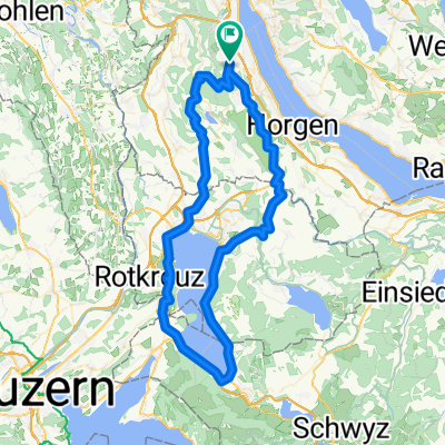
Overview
About this route
Lightly rolling terrain to Rapperswil. Then on the Ironman 70.3 course via Goldingen back to Rapperswil. Continuing to Lützelsee and then the well-deserved coast to Adliswil.
- -:--
- Duration
- 118.1 km
- Distance
- 865 m
- Ascent
- 865 m
- Descent
- ---
- Avg. speed
- ---
- Max. altitude

Route quality
Waytypes & surfaces along the route
Waytypes
Road
41.3 km
(35 %)
Quiet road
21.3 km
(18 %)
Surfaces
Paved
103.9 km
(88 %)
Unpaved
3.5 km
(3 %)
Asphalt
102.7 km
(87 %)
Gravel
2.4 km
(2 %)
Continue with Bikemap
Use, edit, or download this cycling route
You would like to ride Goldingen (VCA-Sommertour) neu or customize it for your own trip? Here is what you can do with this Bikemap route:
Free features
- Save this route as favorite or in collections
- Copy & plan your own version of this route
- Split it into stages to create a multi-day tour
- Sync your route with Garmin or Wahoo
Premium features
Free trial for 3 days, or one-time payment. More about Bikemap Premium.
- Navigate this route on iOS & Android
- Export a GPX / KML file of this route
- Create your custom printout (try it for free)
- Download this route for offline navigation
Discover more Premium features.
Get Bikemap PremiumFrom our community
Other popular routes starting in Adliswil / Adliswil (Stadtkern)
 43 Adliswil-Albispass-Steinhausen-Cham-Zug-Arth Goldau
- Distance
- 42.8 km
- Ascent
- 488 m
- Descent
- 439 m
- Location
- Adliswil / Adliswil (Stadtkern), Canton of Zurich, Switzerland
 Zugersee extended
- Distance
- 81.7 km
- Ascent
- 888 m
- Descent
- 888 m
- Location
- Adliswil / Adliswil (Stadtkern), Canton of Zurich, Switzerland
 Adliswil - Pragel Pass
- Distance
- 150.5 km
- Ascent
- 1,670 m
- Descent
- 1,670 m
- Location
- Adliswil / Adliswil (Stadtkern), Canton of Zurich, Switzerland
 Zipfelweg 6, Adliswil to Poststrasse 11, Adliswil
- Distance
- 9.4 km
- Ascent
- 102 m
- Descent
- 106 m
- Location
- Adliswil / Adliswil (Stadtkern), Canton of Zurich, Switzerland
 Adliswil - Albis - Buchenegg
- Distance
- 21.7 km
- Ascent
- 606 m
- Descent
- 604 m
- Location
- Adliswil / Adliswil (Stadtkern), Canton of Zurich, Switzerland
 Goldingen (VCA-Sommertour) neu
- Distance
- 118.1 km
- Ascent
- 865 m
- Descent
- 865 m
- Location
- Adliswil / Adliswil (Stadtkern), Canton of Zurich, Switzerland
 Adliswil – Hallwiler See
- Distance
- 94.8 km
- Ascent
- 1,701 m
- Descent
- 2,159 m
- Location
- Adliswil / Adliswil (Stadtkern), Canton of Zurich, Switzerland
 BH3 Adliswil 2023 Suss
- Distance
- 7.2 km
- Ascent
- 178 m
- Descent
- 178 m
- Location
- Adliswil / Adliswil (Stadtkern), Canton of Zurich, Switzerland
Open it in the app