Coyote Hills Loop
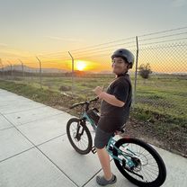
A cycling route starting in Newark, California, United States.
Overview
About this route
Paved, dirt & gravel bicycle trails. Suitable for a road bike in dry conditions.
- -:--
- Duration
- 19 km
- Distance
- 70 m
- Ascent
- 70 m
- Descent
- ---
- Avg. speed
- ---
- Max. altitude
Route quality
Waytypes & surfaces along the route
Waytypes
Track
15.2 km
(80 %)
Quiet road
3.4 km
(18 %)
Surfaces
Paved
7.7 km
(40 %)
Unpaved
11.3 km
(60 %)
Asphalt
7.5 km
(40 %)
Ground
7.1 km
(37 %)
Continue with Bikemap
Use, edit, or download this cycling route
You would like to ride Coyote Hills Loop or customize it for your own trip? Here is what you can do with this Bikemap route:
Free features
- Save this route as favorite or in collections
- Copy & plan your own version of this route
- Sync your route with Garmin or Wahoo
Premium features
Free trial for 3 days, or one-time payment. More about Bikemap Premium.
- Navigate this route on iOS & Android
- Export a GPX / KML file of this route
- Create your custom printout (try it for free)
- Download this route for offline navigation
Discover more Premium features.
Get Bikemap PremiumFrom our community
Other popular routes starting in Newark
- shoreline and creeks
- Distance
- 81.9 km
- Ascent
- 46 m
- Descent
- 46 m
- Location
- Newark, California, United States
- good evening ride
- Distance
- 33.6 km
- Ascent
- 107 m
- Descent
- 111 m
- Location
- Newark, California, United States
- Mount Hemilton
- Distance
- 140.6 km
- Ascent
- 1,527 m
- Descent
- 1,518 m
- Location
- Newark, California, United States
- Coyote Hills
- Distance
- 5.8 km
- Ascent
- 136 m
- Descent
- 136 m
- Location
- Newark, California, United States
- Paseo Padre Loop
- Distance
- 42.6 km
- Ascent
- 142 m
- Descent
- 141 m
- Location
- Newark, California, United States
- Union City Blvd to The Bay
- Distance
- 6.9 km
- Ascent
- 0 m
- Descent
- 0 m
- Location
- Newark, California, United States
- Moderate route in Fremont
- Distance
- 14.1 km
- Ascent
- 0 m
- Descent
- 3 m
- Location
- Newark, California, United States
- Alameda Creek Trail, Hayward to Alameda Creek Trail, Union City
- Distance
- 6.3 km
- Ascent
- 4 m
- Descent
- 4 m
- Location
- Newark, California, United States
Open it in the app