

Trainingsrunde
A cycling route starting in Jena, Thuringia, Germany.
Overview
About this route
Nichts für Oberschenkel-dünnlinge.
Teilweise sehr steil.
Geschicklichkeit ist auch gefragt,da es auf der "Horizontale" teilweise recht eng zu geht.Wenn möglich,früh bei zeiten oder spät abends fahren,damit einem nicht soviel Wanderer und Jogger
entgegen kommen.
(Lehre Flaschen nicht vergessen,für das herrliche Wasser vom "Fürstenbrunnen")
- -:--
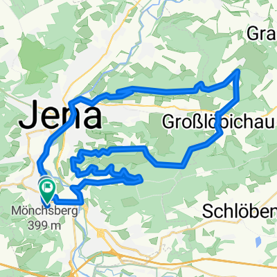
- Duration
- 34.9 km
- Distance
- 559 m
- Ascent
- 558 m
- Descent
- ---
- Avg. speed
- ---
- Max. altitude

Continue with Bikemap
Use, edit, or download this cycling route
You would like to ride Trainingsrunde or customize it for your own trip? Here is what you can do with this Bikemap route:
Free features
- Save this route as favorite or in collections
- Copy & plan your own version of this route
- Sync your route with Garmin or Wahoo
Premium features
Free trial for 3 days, or one-time payment. More about Bikemap Premium.
- Navigate this route on iOS & Android
- Export a GPX / KML file of this route
- Create your custom printout (try it for free)
- Download this route for offline navigation
Discover more Premium features.
Get Bikemap PremiumFrom our community
Other popular routes starting in Jena
 Trainingsrunde
- Distance
- 34.9 km
- Ascent
- 559 m
- Descent
- 558 m
- Location
- Jena, Thuringia, Germany
 Jena-Stadtroda-Jena
- Distance
- 34.6 km
- Ascent
- 280 m
- Descent
- 251 m
- Location
- Jena, Thuringia, Germany
 Tour um Jena, Jägerberg, Isserstedt , Magdala
- Distance
- 37.5 km
- Ascent
- 346 m
- Descent
- 344 m
- Location
- Jena, Thuringia, Germany
 Hohenwarte-Runde
- Distance
- 171.3 km
- Ascent
- 2,292 m
- Descent
- 2,253 m
- Location
- Jena, Thuringia, Germany
 : Halbtagestour mit Kindern
- Distance
- 29.6 km
- Ascent
- 185 m
- Descent
- 201 m
- Location
- Jena, Thuringia, Germany
 4. Etappe Tour de Saale Jena - Naumburg
- Distance
- 55.7 km
- Ascent
- 405 m
- Descent
- 439 m
- Location
- Jena, Thuringia, Germany
 Forst/Ammerbach
- Distance
- 14.2 km
- Ascent
- 291 m
- Descent
- 291 m
- Location
- Jena, Thuringia, Germany
 Jena - Stausee Hohenfelden - Kunitzburg - Jena CLONED FROM ROUTE 1736593
- Distance
- 109.9 km
- Ascent
- 623 m
- Descent
- 623 m
- Location
- Jena, Thuringia, Germany
Open it in the app