

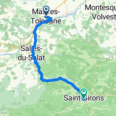
Etape 2 : Boussens - Toulouse
A cycling route starting in Martres-Tolosane, Occitanie, France.
Overview
About this route
Veloroute V83 TransGarona (Fos - Toulouse)
- 4 h 38 min
- Duration
- 78 km
- Distance
- 256 m
- Ascent
- 372 m
- Descent
- 16.8 km/h
- Avg. speed
- 287 m
- Max. altitude

Route quality
Waytypes & surfaces along the route
Waytypes
Quiet road
28.1 km
(36 %)
Road
25 km
(32 %)
Surfaces
Paved
54.6 km
(70 %)
Unpaved
0.8 km
(1 %)
Asphalt
46.8 km
(60 %)
Paved (undefined)
5.5 km
(7 %)
Continue with Bikemap
Use, edit, or download this cycling route
You would like to ride Etape 2 : Boussens - Toulouse or customize it for your own trip? Here is what you can do with this Bikemap route:
Free features
- Save this route as favorite or in collections
- Copy & plan your own version of this route
- Sync your route with Garmin or Wahoo
Premium features
Free trial for 3 days, or one-time payment. More about Bikemap Premium.
- Navigate this route on iOS & Android
- Export a GPX / KML file of this route
- Create your custom printout (try it for free)
- Download this route for offline navigation
Discover more Premium features.
Get Bikemap PremiumFrom our community
Other popular routes starting in Martres-Tolosane
 Etape 2 : Boussens - Toulouse
- Distance
- 78 km
- Ascent
- 256 m
- Descent
- 372 m
- Location
- Martres-Tolosane, Occitanie, France
 claquage
- Distance
- 4.2 km
- Ascent
- 85 m
- Descent
- 72 m
- Location
- Martres-Tolosane, Occitanie, France
 131B Le Moulin, Martres-Tolosane naar 21 Village, Ausseing
- Distance
- 11.3 km
- Ascent
- 298 m
- Descent
- 98 m
- Location
- Martres-Tolosane, Occitanie, France
 13 Martres - Fondeauzard
- Distance
- 85.1 km
- Ascent
- 47 m
- Descent
- 175 m
- Location
- Martres-Tolosane, Occitanie, France
 De Boulevard du Nord 5, Martres-Tolosane à Boulevard Noël Peyrevidal 1, Saint-Girons
- Distance
- 41.1 km
- Ascent
- 486 m
- Descent
- 362 m
- Location
- Martres-Tolosane, Occitanie, France
 Höllentrip ans Ende Europas 1700-1900km
- Distance
- 199.8 km
- Ascent
- 1,242 m
- Descent
- 1,238 m
- Location
- Martres-Tolosane, Occitanie, France
 BOUSSENS - CIERP GAUD
- Distance
- 64.9 km
- Ascent
- 288 m
- Descent
- 67 m
- Location
- Martres-Tolosane, Occitanie, France
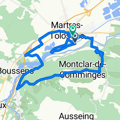 Route in Martres-Tolosane
- Distance
- 21.6 km
- Ascent
- 272 m
- Descent
- 263 m
- Location
- Martres-Tolosane, Occitanie, France
Open it in the app