

Moratalla2012
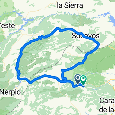
A cycling route starting in Moratalla, Murcia, Spain.
Overview
About this route
Official route of the International Cyclotourist Sierras de Moratalla 2012
- -:--
- Duration
- 170.7 km
- Distance
- 1,949 m
- Ascent
- 1,947 m
- Descent
- ---
- Avg. speed
- ---
- Max. altitude
Route quality
Waytypes & surfaces along the route
Waytypes
Quiet road
30.7 km
(18 %)
Road
25.6 km
(15 %)
Surfaces
Paved
129.7 km
(76 %)
Unpaved
8.5 km
(5 %)
Asphalt
129.7 km
(76 %)
Ground
5.1 km
(3 %)
Continue with Bikemap
Use, edit, or download this cycling route
You would like to ride Moratalla2012 or customize it for your own trip? Here is what you can do with this Bikemap route:
Free features
- Save this route as favorite or in collections
- Copy & plan your own version of this route
- Split it into stages to create a multi-day tour
- Sync your route with Garmin or Wahoo
Premium features
Free trial for 3 days, or one-time payment. More about Bikemap Premium.
- Navigate this route on iOS & Android
- Export a GPX / KML file of this route
- Create your custom printout (try it for free)
- Download this route for offline navigation
Discover more Premium features.
Get Bikemap PremiumFrom our community
Other popular routes starting in Moratalla
 Nº34 Moratalla, Calasparra, Cehegín, Caravaca, archivel, Titoabuelito
- Distance
- 107.5 km
- Ascent
- 1,137 m
- Descent
- 1,130 m
- Location
- Moratalla, Murcia, Spain
 Steady ride
- Distance
- 97.4 km
- Ascent
- 2,196 m
- Descent
- 1,878 m
- Location
- Moratalla, Murcia, Spain
 Nº36 Moratalla,Tazona,Socovos, Colas del Cenajo, Elche,Férez,Titoabuelito
- Distance
- 126.4 km
- Ascent
- 1,232 m
- Descent
- 1,232 m
- Location
- Moratalla, Murcia, Spain
 Previa de Moratalla 2014
- Distance
- 125.1 km
- Ascent
- 1,501 m
- Descent
- 1,498 m
- Location
- Moratalla, Murcia, Spain
 Moratalla - Finisterre
- Distance
- 1,745.6 km
- Ascent
- 2,876 m
- Descent
- 3,481 m
- Location
- Moratalla, Murcia, Spain
 Nº21 Moratalla Cenajo Socovos Benizar San Juan Titoabuelito
- Distance
- 124.7 km
- Ascent
- 1,510 m
- Descent
- 1,471 m
- Location
- Moratalla, Murcia, Spain
 Nº35 Moratalla, Calasparra, Socovos, Benizar, San Juan, Titoabuelito
- Distance
- 99.8 km
- Ascent
- 1,212 m
- Descent
- 1,212 m
- Location
- Moratalla, Murcia, Spain
 Ruta Pre-Moratallla 2016
- Distance
- 117.7 km
- Ascent
- 1,339 m
- Descent
- 1,362 m
- Location
- Moratalla, Murcia, Spain
Open it in the app