
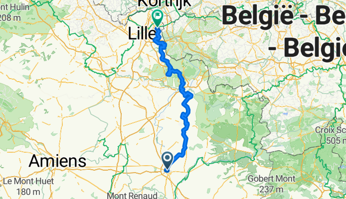
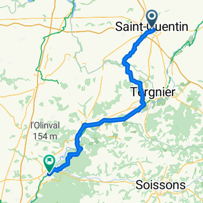
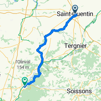
Paris Roubaix Sportive 2012
A cycling route starting in Saint-Quentin, Hauts-de-France, France.
Overview
About this route
- -:--
- Duration
- 158.8 km
- Distance
- 239 m
- Ascent
- 315 m
- Descent
- ---
- Avg. speed
- ---
- Max. altitude

Route quality
Waytypes & surfaces along the route
Waytypes
Road
60.4 km
(38 %)
Quiet road
42.9 km
(27 %)
Surfaces
Paved
49.2 km
(31 %)
Unpaved
3.2 km
(2 %)
Asphalt
49.2 km
(31 %)
Gravel
3.2 km
(2 %)
Undefined
106.4 km
(67 %)
Route highlights
Points of interest along the route
Point of interest after 38.3 km
Sector 19
Point of interest after 44 km
Sector 18
Point of interest after 47.1 km
Sector 17
Point of interest after 51.5 km
Sector 16
Point of interest after 61.2 km
Sector 15
Point of interest after 65.5 km
Sector 14
Point of interest after 69 km
Sector 13
Point of interest after 72.2 km
Sector 12
Point of interest after 83.6 km
Sector 11
Point of interest after 90.9 km
Sector 10
Point of interest after 96.5 km
Sector 9
Point of interest after 102.5 km
Sector 8
Point of interest after 109.4 km
Sector 7
Point of interest after 130 km
Sector 6
Point of interest after 136.1 km
Sector 5
Point of interest after 138.7 km
Sector 4
Point of interest after 141.2 km
Sector 3
Point of interest after 151 km
Sector 2
Point of interest after 158.3 km
Sector 1
Continue with Bikemap
Use, edit, or download this cycling route
You would like to ride Paris Roubaix Sportive 2012 or customize it for your own trip? Here is what you can do with this Bikemap route:
Free features
- Save this route as favorite or in collections
- Copy & plan your own version of this route
- Split it into stages to create a multi-day tour
- Sync your route with Garmin or Wahoo
Premium features
Free trial for 3 days, or one-time payment. More about Bikemap Premium.
- Navigate this route on iOS & Android
- Export a GPX / KML file of this route
- Create your custom printout (try it for free)
- Download this route for offline navigation
Discover more Premium features.
Get Bikemap PremiumFrom our community
Other popular routes starting in Saint-Quentin
 saint-quentin to compiegne
- Distance
- 84.5 km
- Ascent
- 218 m
- Descent
- 280 m
- Location
- Saint-Quentin, Hauts-de-France, France
 wissant
- Distance
- 231.1 km
- Ascent
- 880 m
- Descent
- 975 m
- Location
- Saint-Quentin, Hauts-de-France, France
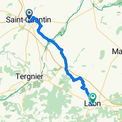 Place de la Basilique, Saint-Quentin to Rue du Cloître, Laon
- Distance
- 53.7 km
- Ascent
- 537 m
- Descent
- 461 m
- Location
- Saint-Quentin, Hauts-de-France, France
 Paris Roubaix Challenge 2011
- Distance
- 156.7 km
- Ascent
- 273 m
- Descent
- 322 m
- Location
- Saint-Quentin, Hauts-de-France, France
 Saint-Quentin - Chauny
- Distance
- 39.5 km
- Ascent
- 103 m
- Descent
- 160 m
- Location
- Saint-Quentin, Hauts-de-France, France
 St Quentin to Soissons
- Distance
- 68 km
- Ascent
- 256 m
- Descent
- 293 m
- Location
- Saint-Quentin, Hauts-de-France, France
 St Quentin to Compiegne
- Distance
- 71.4 km
- Ascent
- 295 m
- Descent
- 367 m
- Location
- Saint-Quentin, Hauts-de-France, France
 Origny-Sainte-Benoite - Pont-Sainte-Maxence
- Distance
- 80.2 km
- Ascent
- 249 m
- Descent
- 316 m
- Location
- Saint-Quentin, Hauts-de-France, France
Open it in the app