

Andrea-MD 20120708
A cycling route starting in Nesselwang, Bavaria, Germany.
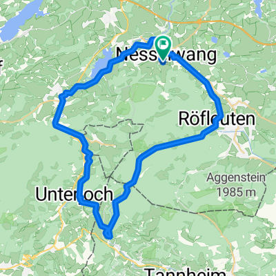
Overview
About this route
Start Nesselwang
Overnight in Zwieseln
Overnight in Mals (Christian)
Overnight in Eppan (Elmar)
Overnight in Val di Sogno (Christian)
Overnight in Mantova
Overnight in Ca Franchi
Overnight in Empoli (Spartaco)
Overnight in Siena (friend of Fabio)
Piombino Ferri
Overnight in Porto Azzurro (Hanne)
Return by train
- -:--
- Duration
- 906.6 km
- Distance
- 3,009 m
- Ascent
- 3,877 m
- Descent
- ---
- Avg. speed
- ---
- Max. altitude
Continue with Bikemap
Use, edit, or download this cycling route
You would like to ride Andrea-MD 20120708 or customize it for your own trip? Here is what you can do with this Bikemap route:
Free features
- Save this route as favorite or in collections
- Copy & plan your own version of this route
- Split it into stages to create a multi-day tour
- Sync your route with Garmin or Wahoo
Premium features
Free trial for 3 days, or one-time payment. More about Bikemap Premium.
- Navigate this route on iOS & Android
- Export a GPX / KML file of this route
- Create your custom printout (try it for free)
- Download this route for offline navigation
Discover more Premium features.
Get Bikemap PremiumFrom our community
Other popular routes starting in Nesselwang
 Nesselwang-Wieskirche
- Distance
- 48.7 km
- Ascent
- 548 m
- Descent
- 596 m
- Location
- Nesselwang, Bavaria, Germany
 Stubentalalm
- Distance
- 22.6 km
- Ascent
- 519 m
- Descent
- 519 m
- Location
- Nesselwang, Bavaria, Germany
 2 Drei-Täler-Radtour Allgäu-Tirol
- Distance
- 66.8 km
- Ascent
- 590 m
- Descent
- 590 m
- Location
- Nesselwang, Bavaria, Germany
 Nesselwang - Grüntensee - Oberellegg und zurück
- Distance
- 25.3 km
- Ascent
- 883 m
- Descent
- 883 m
- Location
- Nesselwang, Bavaria, Germany
 Nesselwang - Wertachtal - Schwarzenberg - Seemoos - Maria Rain
- Distance
- 21.9 km
- Ascent
- 529 m
- Descent
- 532 m
- Location
- Nesselwang, Bavaria, Germany
 Allgäu- Tannheimer Tal
- Distance
- 79.6 km
- Ascent
- 846 m
- Descent
- 851 m
- Location
- Nesselwang, Bavaria, Germany
 Allgäus Trails
- Distance
- 25.2 km
- Ascent
- 1,128 m
- Descent
- 1,116 m
- Location
- Nesselwang, Bavaria, Germany
 Ins benachbarte Tannheimer Tal
- Distance
- 41.4 km
- Ascent
- 349 m
- Descent
- 347 m
- Location
- Nesselwang, Bavaria, Germany
Open it in the app