Goxel-Waldfrieden
- 17.5 km
- 79 m
- 101 m
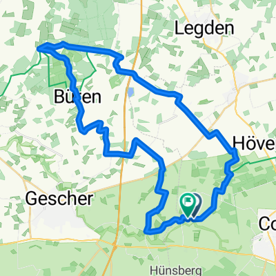
- Coesfeld, North Rhine-Westphalia, Germany
A cycling route starting in Coesfeld, North Rhine-Westphalia, Germany.
Overview
95 km 1000 m elevation gain
For TC de Wildt, from Bennie Evers
created this 13 years ago
Route quality
Quiet road
39.7 km
(43 %)
Road
17.5 km
(19 %)
Paved
50.7 km
(55 %)
Asphalt
48.9 km
(53 %)
Paved (undefined)
1.8 km
(2 %)
Undefined
41.5 km
(45 %)
Continue with Bikemap
You would like to ride Benny's Baumbergetocht or customize it for your own trip? Here is what you can do with this Bikemap route:
Free trial for 3 days, or one-time payment. More about Bikemap Premium.
Discover more Premium features.
Get Bikemap PremiumFrom our community
Open it in the app