
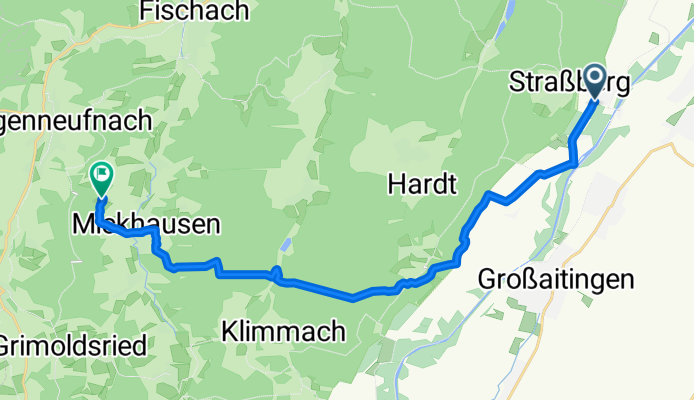
von Bobingen zur Mickhauser Alm
A cycling route starting in Wehringen, Bavaria, Germany.
Overview
About this route
MTB tour with many mountains
- -:--
- Duration
- 18.3 km
- Distance
- 284 m
- Ascent
- 230 m
- Descent
- ---
- Avg. speed
- ---
- Max. altitude
Route quality
Waytypes & surfaces along the route
Waytypes
Track
15.4 km
(84 %)
Road
1.5 km
(8 %)
Surfaces
Paved
4.2 km
(23 %)
Unpaved
13.9 km
(76 %)
Unpaved (undefined)
7 km
(38 %)
Gravel
5.9 km
(32 %)
Route highlights
Points of interest along the route
Point of interest after 18.3 km
Mickhauser Alm mit Biergarten
Continue with Bikemap
Use, edit, or download this cycling route
You would like to ride von Bobingen zur Mickhauser Alm or customize it for your own trip? Here is what you can do with this Bikemap route:
Free features
- Save this route as favorite or in collections
- Copy & plan your own version of this route
- Sync your route with Garmin or Wahoo
Premium features
Free trial for 3 days, or one-time payment. More about Bikemap Premium.
- Navigate this route on iOS & Android
- Export a GPX / KML file of this route
- Create your custom printout (try it for free)
- Download this route for offline navigation
Discover more Premium features.
Get Bikemap PremiumFrom our community
Other popular routes starting in Wehringen
 Höhenmeter-Trainingsrunde in den Stauden
- Distance
- 40.2 km
- Ascent
- 600 m
- Descent
- 600 m
- Location
- Wehringen, Bavaria, Germany
 Climb Track
- Distance
- 5.1 km
- Ascent
- 75 m
- Descent
- 74 m
- Location
- Wehringen, Bavaria, Germany
 Kapellentour
- Distance
- 31.3 km
- Ascent
- 321 m
- Descent
- 321 m
- Location
- Wehringen, Bavaria, Germany
 ww 30
ww 30- Distance
- 27.9 km
- Ascent
- 585 m
- Descent
- 582 m
- Location
- Wehringen, Bavaria, Germany
 von Bobingen zur Mickhauser Alm
- Distance
- 18.3 km
- Ascent
- 284 m
- Descent
- 230 m
- Location
- Wehringen, Bavaria, Germany
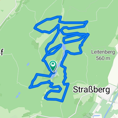
 Kleine Straßberger Biergartenrunde
- Distance
- 13.8 km
- Ascent
- 269 m
- Descent
- 269 m
- Location
- Wehringen, Bavaria, Germany
 Zum Kaffeetrinken nach Bad Wörishofen
- Distance
- 42.1 km
- Ascent
- 130 m
- Descent
- 4 m
- Location
- Wehringen, Bavaria, Germany
 Auf den Spuren der Wildere
- Distance
- 29.5 km
- Ascent
- 425 m
- Descent
- 426 m
- Location
- Wehringen, Bavaria, Germany
Open it in the app