Grenoble - Valence (Cornas) 7:20 114km 680m
A cycling route starting in Gi猫res, Auvergne-Rh么ne-Alpes, France.
Overview
About this route
Leg 3 of Geneva - Mont Ventoux
- 7 h 19 min
- Duration
- 114.1 km
- Distance
- 684 m
- Ascent
- 775 m
- Descent
- 15.6 km/h
- Avg. speed
- 253 m
- Max. altitude
Route quality
Waytypes & surfaces along the route
Waytypes
Cycleway
55.9 km
(49 %)
Quiet road
38.8 km
(34 %)
Surfaces
Paved
77.6 km
(68 %)
Asphalt
77.6 km
(68 %)
Undefined
36.5 km
(32 %)
Continue with Bikemap
Use, edit, or download this cycling route
You would like to ride Grenoble - Valence (Cornas) 7:20 114km 680m or customize it for your own trip? Here is what you can do with this Bikemap route:
Free features
- Save this route as favorite or in collections
- Copy & plan your own version of this route
- Split it into stages to create a multi-day tour
- Sync your route with Garmin or Wahoo
Premium features
Free trial for 3 days, or one-time payment. More about Bikemap Premium.
- Navigate this route on iOS & Android
- Export a GPX / KML file of this route
- Create your custom printout (try it for free)
- Download this route for offline navigation
Discover more Premium features.
Get Bikemap PremiumFrom our community
Other popular routes starting in Gi猫res
- JR_ColDeVence_MontJalla_ViergeNoire
- Distance
- 26.2 km
- Ascent
- 706 m
- Descent
- 705 m
- Location
- Gi猫res, Auvergne-Rh么ne-Alpes, France
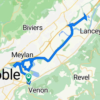
- Balcon de Belledonne
- Distance
- 101.3 km
- Ascent
- 1,569 m
- Descent
- 1,568 m
- Location
- Gi猫res, Auvergne-Rh么ne-Alpes, France
- 211024_Gr茅sivaudan
- Distance
- 55.1 km
- Ascent
- 37 m
- Descent
- 55 m
- Location
- Gi猫res, Auvergne-Rh么ne-Alpes, France
- Autour de l'Is猫re
- Distance
- 19.5 km
- Ascent
- 14 m
- Descent
- 16 m
- Location
- Gi猫res, Auvergne-Rh么ne-Alpes, France
- ffbe
- Distance
- 117.8 km
- Ascent
- 2,007 m
- Descent
- 1,645 m
- Location
- Gi猫res, Auvergne-Rh么ne-Alpes, France
- 220807_U_Gr茅sivaudan__ville_Viz_U
- Distance
- 67.7 km
- Ascent
- 325 m
- Descent
- 330 m
- Location
- Gi猫res, Auvergne-Rh么ne-Alpes, France
- Gi猫res - Vif - Plaine de R茅mur
- Distance
- 53.6 km
- Ascent
- 405 m
- Descent
- 404 m
- Location
- Gi猫res, Auvergne-Rh么ne-Alpes, France
- Croix de Chamrousse
- Distance
- 56.4 km
- Ascent
- 2,029 m
- Descent
- 2,031 m
- Location
- Gi猫res, Auvergne-Rh么ne-Alpes, France
Open it in the app