

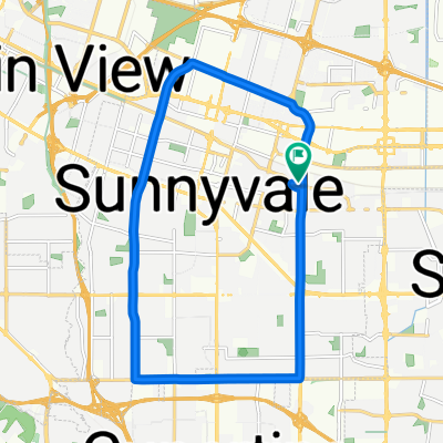
Sunnyvale Baylands Park & Slough
A cycling route starting in Sunnyvale, California, United States.
Overview
About this route
- -:--
- Duration
- 17.1 km
- Distance
- 0 m
- Ascent
- 0 m
- Descent
- ---
- Avg. speed
- ---
- Max. altitude

Continue with Bikemap
Use, edit, or download this cycling route
You would like to ride Sunnyvale Baylands Park & Slough or customize it for your own trip? Here is what you can do with this Bikemap route:
Free features
- Save this route as favorite or in collections
- Copy & plan your own version of this route
- Sync your route with Garmin or Wahoo
Premium features
Free trial for 3 days, or one-time payment. More about Bikemap Premium.
- Navigate this route on iOS & Android
- Export a GPX / KML file of this route
- Create your custom printout (try it for free)
- Download this route for offline navigation
Discover more Premium features.
Get Bikemap PremiumFrom our community
Other popular routes starting in Sunnyvale
 Evelyn & Wolfe, Sunnyvale to South Wolfe Road 175, Sunnyvale
- Distance
- 17.5 km
- Ascent
- 79 m
- Descent
- 79 m
- Location
- Sunnyvale, California, United States
 Sunnyvale-Saratoga loop
- Distance
- 41.5 km
- Ascent
- 445 m
- Descent
- 418 m
- Location
- Sunnyvale, California, United States
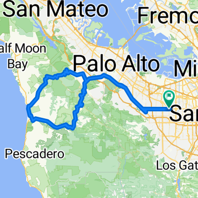 sunnyvale - old la honda - tunitas - sunnyvale
- Distance
- 111 km
- Ascent
- 1,302 m
- Descent
- 1,302 m
- Location
- Sunnyvale, California, United States
 Foothill - Alpine - Arastradero - Foothill
- Distance
- 53.6 km
- Ascent
- 470 m
- Descent
- 470 m
- Location
- Sunnyvale, California, United States
 Montebello Rd - Black mountain
- Distance
- 19 km
- Ascent
- 815 m
- Descent
- 83 m
- Location
- Sunnyvale, California, United States
 Stevens Creek Canyon Road
- Distance
- 54.2 km
- Ascent
- 1,463 m
- Descent
- 1,113 m
- Location
- Sunnyvale, California, United States
 Sunnyvale Evelyn - Stevens Creek Trail - Stevens Creek Reservoir - Hwy 9 - Prospect - Mary - Mathilda
- Distance
- 45.9 km
- Ascent
- 503 m
- Descent
- 495 m
- Location
- Sunnyvale, California, United States
 Stevens Creek - NASA - drive
- Distance
- 24.8 km
- Ascent
- 90 m
- Descent
- 92 m
- Location
- Sunnyvale, California, United States
Open it in the app