

RR-Berg: Bruck/Fuschl-Edelweissspitze/Grossglockner-KaiserFranzJosefshöhe-Heiligenblut
A cycling route starting in Bruck an der Großglocknerstraße, Salzburg, Austria.
Overview
About this route
RR-Berg: Heiligenblut-Edelweissspitze/Grossglockner-Bad Gastein
- 4 h 55 min
- Duration
- 67.1 km
- Distance
- 3,548 m
- Ascent
- 3,061 m
- Descent
- 13.7 km/h
- Avg. speed
- 2,531 m
- Max. altitude

Route quality
Waytypes & surfaces along the route
Waytypes
Road
63.7 km
(95 %)
Track
1.5 km
(2 %)
Surfaces
Paved
65.5 km
(98 %)
Unpaved
0.7 km
(1 %)
Asphalt
65.5 km
(98 %)
Gravel
0.7 km
(1 %)
Undefined
0.9 km
(1 %)
Continue with Bikemap
Use, edit, or download this cycling route
You would like to ride RR-Berg: Bruck/Fuschl-Edelweissspitze/Grossglockner-KaiserFranzJosefshöhe-Heiligenblut or customize it for your own trip? Here is what you can do with this Bikemap route:
Free features
- Save this route as favorite or in collections
- Copy & plan your own version of this route
- Sync your route with Garmin or Wahoo
Premium features
Free trial for 3 days, or one-time payment. More about Bikemap Premium.
- Navigate this route on iOS & Android
- Export a GPX / KML file of this route
- Create your custom printout (try it for free)
- Download this route for offline navigation
Discover more Premium features.
Get Bikemap PremiumFrom our community
Other popular routes starting in Bruck an der Großglocknerstraße
 Großklockner-Fuschertörl
- Distance
- 27 km
- Ascent
- 1,707 m
- Descent
- 225 m
- Location
- Bruck an der Großglocknerstraße, Salzburg, Austria
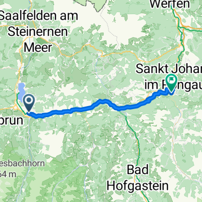 Von Bruck an der Großglocknerstraße bis Sankt Johann im Pongau
- Distance
- 37.6 km
- Ascent
- 944 m
- Descent
- 979 m
- Location
- Bruck an der Großglocknerstraße, Salzburg, Austria
 Glocknerkönig
- Distance
- 27.3 km
- Ascent
- 1,699 m
- Descent
- 222 m
- Location
- Bruck an der Großglocknerstraße, Salzburg, Austria
 Grossglockner and Edelweissspritze
- Distance
- 61.5 km
- Ascent
- 1,827 m
- Descent
- 1,825 m
- Location
- Bruck an der Großglocknerstraße, Salzburg, Austria
 Rakousko 2012-10.den -23.7.Po-část 1.
- Distance
- 71.2 km
- Ascent
- 357 m
- Descent
- 103 m
- Location
- Bruck an der Großglocknerstraße, Salzburg, Austria
 Fusch Grossglockner
- Distance
- 19.1 km
- Ascent
- 1,605 m
- Descent
- 26 m
- Location
- Bruck an der Großglocknerstraße, Salzburg, Austria
 Über den Höchsten den wir haben
- Distance
- 48.5 km
- Ascent
- 2,373 m
- Descent
- 1,642 m
- Location
- Bruck an der Großglocknerstraße, Salzburg, Austria
 Bruck a d G - Edelweißspitze-Großglockner-Heiligenblut-Aichhorn
- Distance
- 72.4 km
- Ascent
- 2,675 m
- Descent
- 2,342 m
- Location
- Bruck an der Großglocknerstraße, Salzburg, Austria
Open it in the app