

Assault on Droop Mountain - Mountain State Wheelers
A cycling route starting in Marlinton, West Virginia, United States.
Overview
About this route
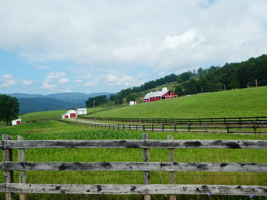
This is a regular ride on the Mountain State Wheelers Bicycle Clubs annual Fall Camping Weekend at Watoga State Park. Very scenic. Work the short side trip to the Droop Mt. Lookout tower. Also a water fountain at the tower.
Assault on Droop Mt.<br />0.0 Start from Beaver Creek Campground - Watoga State Park<br />0.2 Bare right out of the campground<br />0.8 Left to go thru the park.<br />3.0 Right at the lake<br />7.3 Continue thru Seebert.<br />9.6 Left on 219<br />10.9 Right on Lobelia Road at the cooper top church in Hillsboro.<br />12.3 Begin first climb of Droop.<br />14.5 Top of Climb<br />15.7 Bare right to go to Lobelia. Left to shorten ride and go thru Droop Mt. Battlefield State Park.<br />17.4 Begin short steep climb.<br />18.1 Downtown Lobelia<br />18.8 Begin short steep climb 17% plus.<br />20.0 Begin short steep climb.<br />20.4 Keep left in sharp turn and continue down grade.<br />20.7 Begin short steep climb.<br />21.7 Bare left in sharp turn. Do not take Jacox Road.<br />22.5 Begin second climb of Droop Mt.<br />23.9 Left onto US 219<br />24.9 Take left her into Park to go to Droop Mountain overlook tower. Work the side trip.<br />26.5 Right onto Locust Creek Rd. This is a very sharp right before you get to the bottom of the hill.<br />29.6 Left and another immediate Left onto Co. 31/9 and begin climb. Off to the right of this intersection is the Locust Creek Covered Bridge.<br />You can also continue down Co 31 thru Denmar and come back to route.<br />31.5 Continue straight at intersection.<br />35.2 Right on US 219 in Hillboro and start retracing route back to campground.<br />46.5 Finish
- -:--
- Duration
- 74.8 km
- Distance
- 1,016 m
- Ascent
- 1,016 m
- Descent
- ---
- Avg. speed
- ---
- Max. altitude

Route quality
Waytypes & surfaces along the route
Waytypes
Road
38.2 km
(51 %)
Quiet road
29.2 km
(39 %)
Undefined
7.5 km
(10 %)
Surfaces
Paved
21.7 km
(29 %)
Unpaved
0.7 km
(1 %)
Asphalt
20.2 km
(27 %)
Paved (undefined)
1.5 km
(2 %)
Continue with Bikemap
Use, edit, or download this cycling route
You would like to ride Assault on Droop Mountain - Mountain State Wheelers or customize it for your own trip? Here is what you can do with this Bikemap route:
Free features
- Save this route as favorite or in collections
- Copy & plan your own version of this route
- Sync your route with Garmin or Wahoo
Premium features
Free trial for 3 days, or one-time payment. More about Bikemap Premium.
- Navigate this route on iOS & Android
- Export a GPX / KML file of this route
- Create your custom printout (try it for free)
- Download this route for offline navigation
Discover more Premium features.
Get Bikemap PremiumFrom our community
Other popular routes starting in Marlinton
 Assault on Droop Mountain - Mountain State Wheelers
- Distance
- 74.8 km
- Ascent
- 1,016 m
- Descent
- 1,016 m
- Location
- Marlinton, West Virginia, United States
 Marlinton Loop
- Distance
- 63.5 km
- Ascent
- 1,209 m
- Descent
- 1,208 m
- Location
- Marlinton, West Virginia, United States
 Assault on Droop Mountain
- Distance
- 73.7 km
- Ascent
- 1,053 m
- Descent
- 1,053 m
- Location
- Marlinton, West Virginia, United States
 AML (over the ridge)
- Distance
- 92.8 km
- Ascent
- 1,694 m
- Descent
- 1,649 m
- Location
- Marlinton, West Virginia, United States
 Upper Scenic Highway Map
- Distance
- 39.7 km
- Ascent
- 828 m
- Descent
- 828 m
- Location
- Marlinton, West Virginia, United States
 Hillsboro-Lobelia Loop
- Distance
- 28.7 km
- Ascent
- 571 m
- Descent
- 571 m
- Location
- Marlinton, West Virginia, United States
 Clover Lick - Green Bank
- Distance
- 50.3 km
- Ascent
- 546 m
- Descent
- 546 m
- Location
- Marlinton, West Virginia, United States
 Hillsboro - Droop - Locust Creek Loop
- Distance
- 28.6 km
- Ascent
- 421 m
- Descent
- 421 m
- Location
- Marlinton, West Virginia, United States
Open it in the app