

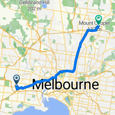
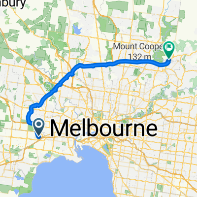
Route from 42 Nolan Avenue, Brooklyn, VIC, 3012
A cycling route starting in Brooklyn, Victoria, Australia.
Overview
About this route
- 2 h 23 min
- Duration
- 38.8 km
- Distance
- 123 m
- Ascent
- 125 m
- Descent
- 16.3 km/h
- Avg. speed
- 80 m
- Avg. speed

Route quality
Waytypes & surfaces along the route
Waytypes
Cycleway
37 km
(95 %)
Quiet road
1.1 km
(3 %)
Surfaces
Paved
34.8 km
(90 %)
Unpaved
0.8 km
(2 %)
Concrete
17.3 km
(44 %)
Asphalt
16.9 km
(43 %)
Continue with Bikemap
Use, edit, or download this cycling route
You would like to ride Route from 42 Nolan Avenue, Brooklyn, VIC, 3012 or customize it for your own trip? Here is what you can do with this Bikemap route:
Free features
- Save this route as favorite or in collections
- Copy & plan your own version of this route
- Sync your route with Garmin or Wahoo
Premium features
Free trial for 3 days, or one-time payment. More about Bikemap Premium.
- Navigate this route on iOS & Android
- Export a GPX / KML file of this route
- Create your custom printout (try it for free)
- Download this route for offline navigation
Discover more Premium features.
Get Bikemap PremiumFrom our community
Other popular routes starting in Brooklyn
 2 Viola Ave, Brooklyn to 2A Viola Ave, Brooklyn
- Distance
- 3 km
- Ascent
- 6 m
- Descent
- 7 m
- Location
- Brooklyn, Victoria, Australia
 Technology Drive 107, Sunshine West to Belmont Way 16, Mill Park
- Distance
- 33.6 km
- Ascent
- 182 m
- Descent
- 102 m
- Location
- Brooklyn, Victoria, Australia
 Little Boundary Rd, Laverton North to Lindsay Gardens, Point Cook
- Distance
- 32.4 km
- Ascent
- 58 m
- Descent
- 70 m
- Location
- Brooklyn, Victoria, Australia
 541-545 Somerville Rd, Sunshine West to 37 Strzelecki Ave, Sunshine West
- Distance
- 0.8 km
- Ascent
- 0 m
- Descent
- 0 m
- Location
- Brooklyn, Victoria, Australia
 Western Rng Rd Trail (E2E)
- Distance
- 44.6 km
- Ascent
- 253 m
- Descent
- 148 m
- Location
- Brooklyn, Victoria, Australia
 Scott Road, Laverton North to Western Ring Road Path, Laverton North
- Distance
- 3.1 km
- Ascent
- 16 m
- Descent
- 7 m
- Location
- Brooklyn, Victoria, Australia
 Progress Ct, Laverton North to Edge View, Point Cook
- Distance
- 51.7 km
- Ascent
- 31 m
- Descent
- 51 m
- Location
- Brooklyn, Victoria, Australia
 Western Freeway to Memphis Drive Truganina
- Distance
- 10.1 km
- Ascent
- 26 m
- Descent
- 23 m
- Location
- Brooklyn, Victoria, Australia
Open it in the app