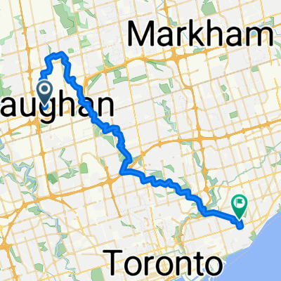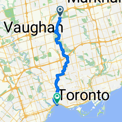
Keele and Finch to Indian Road between Missisauga rd and Southdown rd
- 44.3 km
- 93 m
- 193 m
- Concord, Ontario, Canada
A cycling route starting in Concord, Ontario, Canada.
Overview
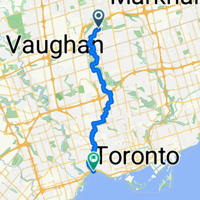
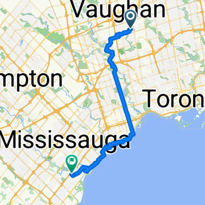
45 KM 6 Hour Slow Bike Ride:
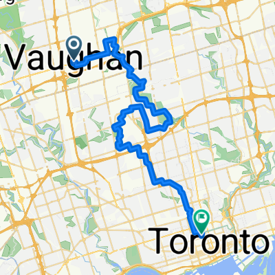
Vaughan Station to Queens Park Via Bartley Smith Greenway, Hidden Trail, G Ross Lord, Earl Bales Downsview Park
created this 1 year ago
Route quality
Quiet road
21.9 km
(49 %)
Cycleway
8.5 km
(19 %)
Paved
40.6 km
(91 %)
Unpaved
0.9 km
(2 %)
Asphalt
38.8 km
(87 %)
Concrete
1.3 km
(3 %)
Continue with Bikemap
You would like to ride Vaughan Station to Queens Park Via Bartley Smith Greenway, Hidden Trail, G Ross Lord, Earl Bales Downsview Park or customize it for your own trip? Here is what you can do with this Bikemap route:
Free trial for 3 days, or one-time payment. More about Bikemap Premium.
Discover more Premium features.
Get Bikemap PremiumFrom our community
Open it in the app