

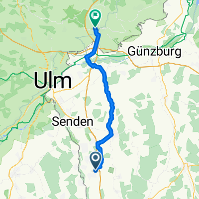
Schwäbische Cafè-Tour-II - Illert-Gerlenhofen
A cycling route starting in Illertissen, Bavaria, Germany.
Overview
About this route
- 4 h 55 min
- Duration
- 76.7 km
- Distance
- 577 m
- Ascent
- 607 m
- Descent
- 15.6 km/h
- Avg. speed
- 636 m
- Max. altitude
Route quality
Waytypes & surfaces along the route
Waytypes
Quiet road
23.8 km
(31 %)
Track
17.6 km
(23 %)
Surfaces
Paved
62.1 km
(81 %)
Unpaved
6.9 km
(9 %)
Asphalt
60.6 km
(79 %)
Gravel
6.1 km
(8 %)
Continue with Bikemap
Use, edit, or download this cycling route
You would like to ride Schwäbische Cafè-Tour-II - Illert-Gerlenhofen or customize it for your own trip? Here is what you can do with this Bikemap route:
Free features
- Save this route as favorite or in collections
- Copy & plan your own version of this route
- Sync your route with Garmin or Wahoo
Premium features
Free trial for 3 days, or one-time payment. More about Bikemap Premium.
- Navigate this route on iOS & Android
- Export a GPX / KML file of this route
- Create your custom printout (try it for free)
- Download this route for offline navigation
Discover more Premium features.
Get Bikemap PremiumFrom our community
Other popular routes starting in Illertissen
 Illertissen, Erolzheim, Memmingen, Illertissen
- Distance
- 54.1 km
- Ascent
- 188 m
- Descent
- 180 m
- Location
- Illertissen, Bavaria, Germany
 Großen Runde Illertissen-Pfaffenhofen
- Distance
- 42.7 km
- Ascent
- 89 m
- Descent
- 97 m
- Location
- Illertissen, Bavaria, Germany
 Kellmünz-Rothtal-Illertissen
- Distance
- 63.9 km
- Ascent
- 297 m
- Descent
- 297 m
- Location
- Illertissen, Bavaria, Germany
 Oberschwaben- Abstecher 2018
- Distance
- 80.6 km
- Ascent
- 382 m
- Descent
- 381 m
- Location
- Illertissen, Bavaria, Germany
 Illertal 10, Illertissen nach Haslacher Weg 81, Ulm
- Distance
- 30.2 km
- Ascent
- 104 m
- Descent
- 71 m
- Location
- Illertissen, Bavaria, Germany
 Allgäu Rundfahrt 2018
- Distance
- 449.4 km
- Ascent
- 1,763 m
- Descent
- 1,763 m
- Location
- Illertissen, Bavaria, Germany
 Illertissen-Langenau
- Distance
- 39.7 km
- Ascent
- 127 m
- Descent
- 155 m
- Location
- Illertissen, Bavaria, Germany
 Zum Picknick an den Fuggerweiher
- Distance
- 55.3 km
- Ascent
- 380 m
- Descent
- 386 m
- Location
- Illertissen, Bavaria, Germany
Open it in the app