Calberlah - Bernsteinsee
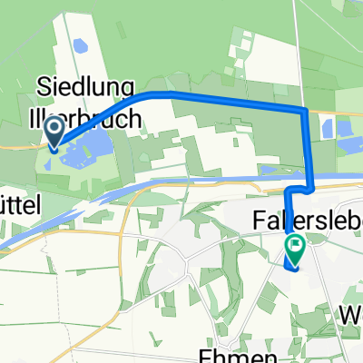
A cycling route starting in Calberlah, Lower Saxony, Germany.
Overview
About this route
Von Calberlah am Elbeseitenkanal entlang bis zum Bernsteinsee und über Landstraßen zurück
- -:--
- Duration
- 46.1 km
- Distance
- 56 m
- Ascent
- 58 m
- Descent
- ---
- Avg. speed
- 83 m
- Max. altitude
Route quality
Waytypes & surfaces along the route
Waytypes
Access road
18.7 km
(41 %)
Quiet road
10.7 km
(23 %)
Surfaces
Paved
27.1 km
(59 %)
Unpaved
17.3 km
(38 %)
Asphalt
17.5 km
(38 %)
Paving stones
9.5 km
(21 %)
Continue with Bikemap
Use, edit, or download this cycling route
You would like to ride Calberlah - Bernsteinsee or customize it for your own trip? Here is what you can do with this Bikemap route:
Free features
- Save this route as favorite or in collections
- Copy & plan your own version of this route
- Sync your route with Garmin or Wahoo
Premium features
Free trial for 3 days, or one-time payment. More about Bikemap Premium.
- Navigate this route on iOS & Android
- Export a GPX / KML file of this route
- Create your custom printout (try it for free)
- Download this route for offline navigation
Discover more Premium features.
Get Bikemap PremiumFrom our community
Other popular routes starting in Calberlah
- Calberlah - Isenbüttel - Ausbüttel - Meine - Ohnhorst
- Distance
- 23.5 km
- Ascent
- 41 m
- Descent
- 40 m
- Location
- Calberlah, Lower Saxony, Germany
- Calberlah - Schwülper - Hillerse - Meinersen - Gifhorn
- Distance
- 73.4 km
- Ascent
- 125 m
- Descent
- 125 m
- Location
- Calberlah, Lower Saxony, Germany
- Calberlah - Stüde - Calberlah
- Distance
- 48 km
- Ascent
- 96 m
- Descent
- 105 m
- Location
- Calberlah, Lower Saxony, Germany
- Calberlah - Gifhorner Heiden - Viehmoor - Hillerse - Adenbüttel - Röttgesbüttel - Helmsheide u.z.
- Distance
- 47.1 km
- Ascent
- 73 m
- Descent
- 73 m
- Location
- Calberlah, Lower Saxony, Germany
- Calberlah - Lagesbüttel 2 Kanalufer Süd - wen
- Distance
- 18.9 km
- Ascent
- 50 m
- Descent
- 43 m
- Location
- Calberlah, Lower Saxony, Germany
- 123456
- Distance
- 7.4 km
- Ascent
- 31 m
- Descent
- 8 m
- Location
- Calberlah, Lower Saxony, Germany
- 20151226_122444.gpx
- Distance
- 32.9 km
- Ascent
- 53 m
- Descent
- 55 m
- Location
- Calberlah, Lower Saxony, Germany
- Tankumsee, Weyhausen, Jembke, Westerbeck, Tankumsee
- Distance
- 45.7 km
- Ascent
- 186 m
- Descent
- 189 m
- Location
- Calberlah, Lower Saxony, Germany
Open it in the app