

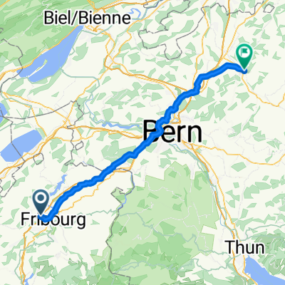
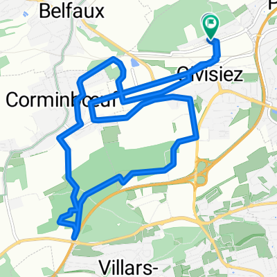
Giv. - Gurnigel - Giv.
A cycling route starting in Givisiez, Canton of Fribourg, Switzerland.
Overview
About this route
- -:--
- Duration
- 82 km
- Distance
- 1,870 m
- Ascent
- 1,861 m
- Descent
- ---
- Avg. speed
- 1,613 m
- Max. altitude
Route quality
Waytypes & surfaces along the route
Waytypes
Road
26.2 km
(32 %)
Quiet road
4.1 km
(5 %)
Surfaces
Paved
30.3 km
(37 %)
Unpaved
1.6 km
(2 %)
Asphalt
28.7 km
(35 %)
Paved (undefined)
1.6 km
(2 %)
Continue with Bikemap
Use, edit, or download this cycling route
You would like to ride Giv. - Gurnigel - Giv. or customize it for your own trip? Here is what you can do with this Bikemap route:
Free features
- Save this route as favorite or in collections
- Copy & plan your own version of this route
- Split it into stages to create a multi-day tour
- Sync your route with Garmin or Wahoo
Premium features
Free trial for 3 days, or one-time payment. More about Bikemap Premium.
- Navigate this route on iOS & Android
- Export a GPX / KML file of this route
- Create your custom printout (try it for free)
- Download this route for offline navigation
Discover more Premium features.
Get Bikemap PremiumFrom our community
Other popular routes starting in Givisiez
 Route de Belfaux 3, Givisiez nach Burgdorf, Kronenplatz
- Distance
- 57.9 km
- Ascent
- 840 m
- Descent
- 911 m
- Location
- Givisiez, Canton of Fribourg, Switzerland
 Route Jo Siffert 36, Givisiez nach Riedern 10, Ueberstorf
- Distance
- 24.5 km
- Ascent
- 166 m
- Descent
- 123 m
- Location
- Givisiez, Canton of Fribourg, Switzerland
 FR-Berra-Rossens-Gibloux-Bulle (Bergibike)
- Distance
- 71.7 km
- Ascent
- 2,596 m
- Descent
- 2,447 m
- Location
- Givisiez, Canton of Fribourg, Switzerland
 De Route de Belfaux 3, Givisiez à Route de l'Épinay 8, Givisiez
- Distance
- 0.3 km
- Ascent
- 13 m
- Descent
- 7 m
- Location
- Givisiez, Canton of Fribourg, Switzerland
 Route stable en Givisiez
- Distance
- 12.6 km
- Ascent
- 602 m
- Descent
- 606 m
- Location
- Givisiez, Canton of Fribourg, Switzerland
 SCOTT Lunch Ride - Schiffenensee
- Distance
- 30.1 km
- Ascent
- 376 m
- Descent
- 373 m
- Location
- Givisiez, Canton of Fribourg, Switzerland
 Itinéraire confortable en Givisiez
- Distance
- 18.3 km
- Ascent
- 651 m
- Descent
- 652 m
- Location
- Givisiez, Canton of Fribourg, Switzerland
 De Ä?˜˙? à Ä?˜˙?
- Distance
- 17.9 km
- Ascent
- 526 m
- Descent
- 524 m
- Location
- Givisiez, Canton of Fribourg, Switzerland
Open it in the app