

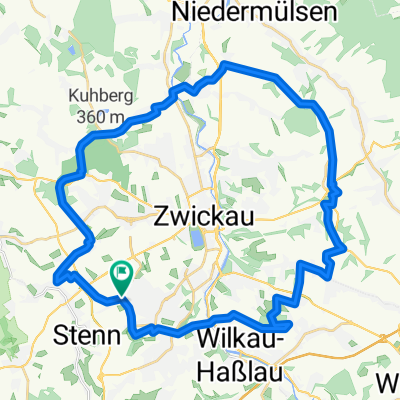
Marienthal - Niederschindmaas
A cycling route starting in Lichtentanne, Saxony, Germany.
Overview
About this route
- Familien tauglich
-VORSICHT : ...auf dem Mulderadweg von Zwickau bis Mosel - viele Fußgänger und auch beklop. Radfahrer in Mengen unterwegs
- -:--
- Duration
- 18.4 km
- Distance
- 0 m
- Ascent
- 79 m
- Descent
- ---
- Avg. speed
- 328 m
- Max. altitude

Route quality
Waytypes & surfaces along the route
Waytypes
Path
7.3 km
(40 %)
Quiet road
4.4 km
(24 %)
Surfaces
Paved
12.6 km
(68 %)
Unpaved
3.4 km
(19 %)
Asphalt
10 km
(55 %)
Paving stones
2.1 km
(12 %)
Route highlights
Points of interest along the route
Point of interest after 13.3 km
-Rastplatz mit festem Grill und Sitzplätzen
Point of interest after 16.5 km
-Pension Zur Scheune Am Dorfteich 6 08058 Schlunzig Tel: 037604 - 7880
Point of interest after 17.4 km
... hier rechts und ab gehts zum Naherholungsgebiet Stausee Glauchau -ca. 500m hinter Schlunzig
Continue with Bikemap
Use, edit, or download this cycling route
You would like to ride Marienthal - Niederschindmaas or customize it for your own trip? Here is what you can do with this Bikemap route:
Free features
- Save this route as favorite or in collections
- Copy & plan your own version of this route
- Sync your route with Garmin or Wahoo
Premium features
Free trial for 3 days, or one-time payment. More about Bikemap Premium.
- Navigate this route on iOS & Android
- Export a GPX / KML file of this route
- Create your custom printout (try it for free)
- Download this route for offline navigation
Discover more Premium features.
Get Bikemap PremiumFrom our community
Other popular routes starting in Lichtentanne
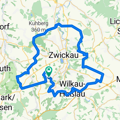
 Zwickau - Kirchberg
- Distance
- 33.9 km
- Ascent
- 280 m
- Descent
- 304 m
- Location
- Lichtentanne, Saxony, Germany
 Rund um Zwickau ( Kl. Runde )
- Distance
- 39.2 km
- Ascent
- 422 m
- Descent
- 426 m
- Location
- Lichtentanne, Saxony, Germany
 Huegelig Kirchberg Niedercrinitz Rottmannsdorf
- Distance
- 35.7 km
- Ascent
- 542 m
- Descent
- 542 m
- Location
- Lichtentanne, Saxony, Germany
 Thanhof-Kirchberg-Eibenstock-Auerbach-Lengenfeld-Gospersgrün
- Distance
- 87.6 km
- Ascent
- 786 m
- Descent
- 786 m
- Location
- Lichtentanne, Saxony, Germany
 Männertag 2015
- Distance
- 286.4 km
- Ascent
- 202 m
- Descent
- 408 m
- Location
- Lichtentanne, Saxony, Germany
 Waldkirchen Tourplan
- Distance
- 36.8 km
- Ascent
- 439 m
- Descent
- 439 m
- Location
- Lichtentanne, Saxony, Germany
 Marienthal - Niederschindmaas
- Distance
- 18.4 km
- Ascent
- 0 m
- Descent
- 79 m
- Location
- Lichtentanne, Saxony, Germany
 Rund um Zwickau
- Distance
- 49.9 km
- Ascent
- 547 m
- Descent
- 547 m
- Location
- Lichtentanne, Saxony, Germany
Open it in the app