

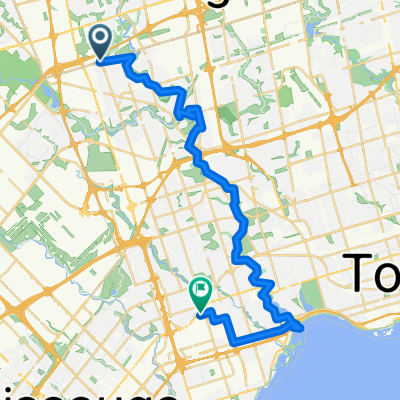
Vaughan to Downsview Park Via Maple, BS Greenway, G Ross Lord, Earl Bales
A cycling route starting in Concord, Ontario, Canada.
Overview
About this route
50KM 6.25 hour Slow bike ride to Maple Vaughan to Downsview Park Via Maple, BS Greenway, G Ross Lord, Earl Bales
- 3 h 6 min
- Duration
- 49.4 km
- Distance
- 204 m
- Ascent
- 210 m
- Descent
- 16 km/h
- Avg. speed
- 251 m
- Max. altitude

Route quality
Waytypes & surfaces along the route
Waytypes
Quiet road
17.8 km
(36 %)
Path
12 km
(24 %)
Surfaces
Paved
38.6 km
(78 %)
Unpaved
5.5 km
(11 %)
Asphalt
35.2 km
(71 %)
Unpaved (undefined)
4 km
(8 %)
Continue with Bikemap
Use, edit, or download this cycling route
You would like to ride Vaughan to Downsview Park Via Maple, BS Greenway, G Ross Lord, Earl Bales or customize it for your own trip? Here is what you can do with this Bikemap route:
Free features
- Save this route as favorite or in collections
- Copy & plan your own version of this route
- Sync your route with Garmin or Wahoo
Premium features
Free trial for 3 days, or one-time payment. More about Bikemap Premium.
- Navigate this route on iOS & Android
- Export a GPX / KML file of this route
- Create your custom printout (try it for free)
- Download this route for offline navigation
Discover more Premium features.
Get Bikemap PremiumFrom our community
Other popular routes starting in Concord
 kcc100
- Distance
- 105.2 km
- Ascent
- 345 m
- Descent
- 343 m
- Location
- Concord, Ontario, Canada
 Downsview Station to High Park Zoo Via West Humber, Etobicoke Creek, Centennial Park, Duck Pond
- Distance
- 60.4 km
- Ascent
- 354 m
- Descent
- 432 m
- Location
- Concord, Ontario, Canada
 Downsview Park to Claireville Ranch and BAPS
- Distance
- 50.2 km
- Ascent
- 306 m
- Descent
- 307 m
- Location
- Concord, Ontario, Canada
 Lake Wilcox Vishnu Mandir
- Distance
- 64.3 km
- Ascent
- 430 m
- Descent
- 432 m
- Location
- Concord, Ontario, Canada
 Humber Recreational Trail
- Distance
- 24.5 km
- Ascent
- 73 m
- Descent
- 143 m
- Location
- Concord, Ontario, Canada
 humber river
- Distance
- 37.1 km
- Ascent
- 397 m
- Descent
- 455 m
- Location
- Concord, Ontario, Canada
 Vaughan station to Kortright conservation park
- Distance
- 31.1 km
- Ascent
- 475 m
- Descent
- 475 m
- Location
- Concord, Ontario, Canada
 De Shoreham Drive 30, Toronto a Martin Goodman Trail, Toronto
- Distance
- 27.3 km
- Ascent
- 260 m
- Descent
- 369 m
- Location
- Concord, Ontario, Canada
Open it in the app