

Erzurum Tbilisi
A cycling route starting in Yakutiye, Erzurum Province, Republic of Türkiye.
Overview
About this route
- -:--
- Duration
- 534.9 km
- Distance
- ---
- Ascent
- ---
- Descent
- ---
- Avg. speed
- ---
- Max. altitude

Continue with Bikemap
Use, edit, or download this cycling route
You would like to ride Erzurum Tbilisi or customize it for your own trip? Here is what you can do with this Bikemap route:
Free features
- Save this route as favorite or in collections
- Copy & plan your own version of this route
- Split it into stages to create a multi-day tour
- Sync your route with Garmin or Wahoo
Premium features
Free trial for 3 days, or one-time payment. More about Bikemap Premium.
- Navigate this route on iOS & Android
- Export a GPX / KML file of this route
- Create your custom printout (try it for free)
- Download this route for offline navigation
Discover more Premium features.
Get Bikemap PremiumFrom our community
Other popular routes starting in Yakutiye
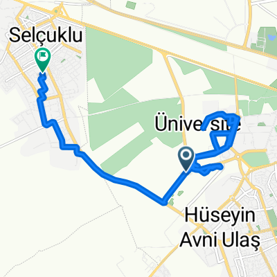
 Fatih Sultan Mehmet Bulvarı 6 to Sakıp Efendi Caddesi 18
- Distance
- 42.5 km
- Ascent
- 147 m
- Descent
- 79 m
- Location
- Yakutiye, Erzurum Province, Republic of Türkiye
 Phone broke
- Distance
- 204.8 km
- Ascent
- 828 m
- Descent
- 1,004 m
- Location
- Yakutiye, Erzurum Province, Republic of Türkiye
 Fatih Sultan Mehmet Bulvarı 27 to Alparslan Türkeş Bulvarı 74
- Distance
- 6.5 km
- Ascent
- 113 m
- Descent
- 158 m
- Location
- Yakutiye, Erzurum Province, Republic of Türkiye
 AÜ Ziraat Fak. Koyunculuk Şubesi to Aliye İzzet Begoviç Caddesi, Gez Osb
- Distance
- 14.1 km
- Ascent
- 144 m
- Descent
- 228 m
- Location
- Yakutiye, Erzurum Province, Republic of Türkiye
 Erzurum Tbilisi
- Distance
- 534.9 km
- Ascent
- ---
- Descent
- ---
- Location
- Yakutiye, Erzurum Province, Republic of Türkiye
 erzurum tbilisi
- Distance
- 534.9 km
- Ascent
- 2,753 m
- Descent
- 4,258 m
- Location
- Yakutiye, Erzurum Province, Republic of Türkiye
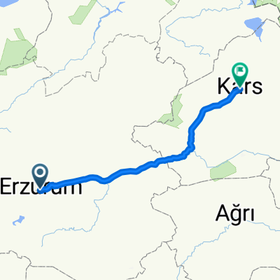 Erzurum - Kars
- Distance
- 203.2 km
- Ascent
- 1,572 m
- Descent
- 1,744 m
- Location
- Yakutiye, Erzurum Province, Republic of Türkiye
 Dere Caddesi 45 to Erzurum Artvin Yol
- Distance
- 95 km
- Ascent
- 422 m
- Descent
- 768 m
- Location
- Yakutiye, Erzurum Province, Republic of Türkiye
Open it in the app