

82 km zvl
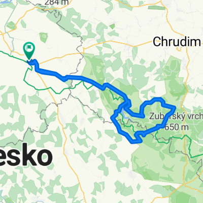
A cycling route starting in Čáslav, Central Bohemia, Czechia.
Overview
About this route
The more information you write here, the more useful it will be for other users.* The route's course.* What is special about this route?* Why recommend this route?* What did you like most here?* etc.
- -:--
- Duration
- 81.9 km
- Distance
- 365 m
- Ascent
- 346 m
- Descent
- ---
- Avg. speed
- ---
- Max. altitude

Route quality
Waytypes & surfaces along the route
Waytypes
Road
33.6 km
(41 %)
Quiet road
4.1 km
(5 %)
Surfaces
Paved
36.8 km
(45 %)
Asphalt
36.8 km
(45 %)
Undefined
45 km
(55 %)
Continue with Bikemap
Use, edit, or download this cycling route
You would like to ride 82 km zvl or customize it for your own trip? Here is what you can do with this Bikemap route:
Free features
- Save this route as favorite or in collections
- Copy & plan your own version of this route
- Split it into stages to create a multi-day tour
- Sync your route with Garmin or Wahoo
Premium features
Free trial for 3 days, or one-time payment. More about Bikemap Premium.
- Navigate this route on iOS & Android
- Export a GPX / KML file of this route
- Create your custom printout (try it for free)
- Download this route for offline navigation
Discover more Premium features.
Get Bikemap PremiumFrom our community
Other popular routes starting in Čáslav
 Čáslav - Kačina - Čáslav
- Distance
- 36.2 km
- Ascent
- 109 m
- Descent
- 109 m
- Location
- Čáslav, Central Bohemia, Czechia
 96 kopce Seč
- Distance
- 96.3 km
- Ascent
- 965 m
- Descent
- 965 m
- Location
- Čáslav, Central Bohemia, Czechia
 Čáslav - Vrdy - Vynaře - Starkoč - Čáslav
- Distance
- 29.1 km
- Ascent
- 136 m
- Descent
- 136 m
- Location
- Čáslav, Central Bohemia, Czechia
 Zubr
Zubr- Distance
- 79.4 km
- Ascent
- 844 m
- Descent
- 819 m
- Location
- Čáslav, Central Bohemia, Czechia
 80 km rov
- Distance
- 80 km
- Ascent
- 270 m
- Descent
- 271 m
- Location
- Čáslav, Central Bohemia, Czechia
 Caslav - Tisa skala
- Distance
- 8.5 km
- Ascent
- 146 m
- Descent
- 28 m
- Location
- Čáslav, Central Bohemia, Czechia
 Chotusice - St. Kolín - Červené Pečky - Kutná Hora - Chotusice
- Distance
- 51.9 km
- Ascent
- 324 m
- Descent
- 324 m
- Location
- Čáslav, Central Bohemia, Czechia
 Čáslav - Vodranty - Žaky - Žleby - Bílé Podolí - Čáslav
- Distance
- 46 km
- Ascent
- 272 m
- Descent
- 265 m
- Location
- Čáslav, Central Bohemia, Czechia
Open it in the app