

Day-twentynine-3
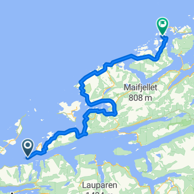
A cycling route starting in Brattvåg, Møre og Romsdal, Norway.
Overview
About this route
- 1 h 7 min
- Duration
- 18.7 km
- Distance
- 289 m
- Ascent
- 255 m
- Descent
- 16.8 km/h
- Avg. speed
- 88 m
- Max. altitude

Route quality
Waytypes & surfaces along the route
Waytypes
Quiet road
5.2 km
(28 %)
Access road
0.2 km
(1 %)
Continue with Bikemap
Use, edit, or download this cycling route
You would like to ride Day-twentynine-3 or customize it for your own trip? Here is what you can do with this Bikemap route:
Free features
- Save this route as favorite or in collections
- Copy & plan your own version of this route
- Sync your route with Garmin or Wahoo
Premium features
Free trial for 3 days, or one-time payment. More about Bikemap Premium.
- Navigate this route on iOS & Android
- Export a GPX / KML file of this route
- Create your custom printout (try it for free)
- Download this route for offline navigation
Discover more Premium features.
Get Bikemap PremiumFrom our community
Other popular routes starting in Brattvåg
 Itinéraire à partir de Midøyvegen 1359
- Distance
- 31.9 km
- Ascent
- 795 m
- Descent
- 802 m
- Location
- Brattvåg, Møre og Romsdal, Norway
 2F Midøya - Averøya
- Distance
- 143.8 km
- Ascent
- 1,886 m
- Descent
- 1,882 m
- Location
- Brattvåg, Møre og Romsdal, Norway
 043: Brattvag– Sovik (DEVELOPED)
- Distance
- 19.2 km
- Ascent
- 169 m
- Descent
- 167 m
- Location
- Brattvåg, Møre og Romsdal, Norway
 Haramsrunden - Lang
- Distance
- 111.3 km
- Ascent
- 591 m
- Descent
- 590 m
- Location
- Brattvåg, Møre og Romsdal, Norway
 Gryta-Fannedalen-Brattvåg-Hildre-Gryta
- Distance
- 57.9 km
- Ascent
- 480 m
- Descent
- 480 m
- Location
- Brattvåg, Møre og Romsdal, Norway
 Nor 4 dzień A i R
- Distance
- 148.4 km
- Ascent
- 712 m
- Descent
- 449 m
- Location
- Brattvåg, Møre og Romsdal, Norway
 Gryta-Fiksdal-Vestrefjord-Gryta
- Distance
- 72.6 km
- Ascent
- 682 m
- Descent
- 681 m
- Location
- Brattvåg, Møre og Romsdal, Norway
 De Ferjevegen 6270 à Hamnsundvegen 7
- Distance
- 18.2 km
- Ascent
- 290 m
- Descent
- 227 m
- Location
- Brattvåg, Møre og Romsdal, Norway
Open it in the app