

Dzień 13 ( 23 lipca ) MC Camping- Droga Atlantycka-Kristiansund
A cycling route starting in Eide, Møre og Romsdal, Norway.
Overview
About this route
Po wczorajszym mokrym i zimnym dniu - dzisiaj od rana super pogoda.
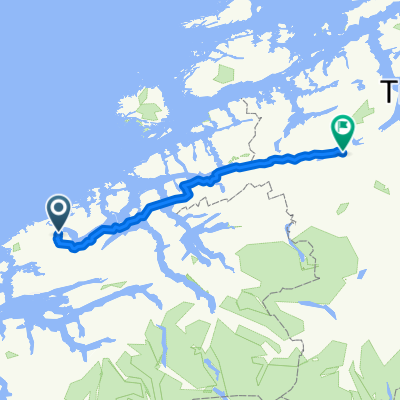
20 km jazdy i wjeżdżamy na Drogę Atlantycką.Cały czas drogą Nr 64.
Opisy w przewodnikach ani trochę nie przesadzone. Połączenie technicznych rozwiązań komunikacyjnych i natury zapiera dech.Trudno się przemieszczać, gdy co kilkaset metrów jest widok, który koniecznie trzeba utrwalić na zdjęciu.
Niestety rowerzystom nie wolno wjeżdżać do tunelu prowadzącego do Kristiansund ( Atlanterhavstunnelen biegnie pod powierzchnią Morza).Do miasta zabiera nas specjalnie kursujący autobus przystosowany do transportu rowerów i bagaży.
- -:--
- Duration
- 59.6 km
- Distance
- 370 m
- Ascent
- 375 m
- Descent
- ---
- Avg. speed
- ---
- Max. altitude
Continue with Bikemap
Use, edit, or download this cycling route
You would like to ride Dzień 13 ( 23 lipca ) MC Camping- Droga Atlantycka-Kristiansund or customize it for your own trip? Here is what you can do with this Bikemap route:
Free features
- Save this route as favorite or in collections
- Copy & plan your own version of this route
- Sync your route with Garmin or Wahoo
Premium features
Free trial for 3 days, or one-time payment. More about Bikemap Premium.
- Navigate this route on iOS & Android
- Export a GPX / KML file of this route
- Create your custom printout (try it for free)
- Download this route for offline navigation
Discover more Premium features.
Get Bikemap PremiumFrom our community
Other popular routes starting in Eide
 040: Karvag– Elnesvagen (DEVELOPED)
- Distance
- 54.2 km
- Ascent
- 253 m
- Descent
- 222 m
- Location
- Eide, Møre og Romsdal, Norway
 aksia hogkjolen
- Distance
- 144.3 km
- Ascent
- 858 m
- Descent
- 585 m
- Location
- Eide, Møre og Romsdal, Norway
 Dzień 13 ( 23 lipca ) MC Camping- Droga Atlantycka-Kristiansund
- Distance
- 59.6 km
- Ascent
- 370 m
- Descent
- 375 m
- Location
- Eide, Møre og Romsdal, Norway
 Atlantic Highway
- Distance
- 8.2 km
- Ascent
- 47 m
- Descent
- 46 m
- Location
- Eide, Møre og Romsdal, Norway
 Dzień 24 - Follandsvatnet - Karvag - Bruhagen - Bremsnes - Kristiansund - Trondheim
- Distance
- 32.4 km
- Ascent
- 0 m
- Descent
- 0 m
- Location
- Eide, Møre og Romsdal, Norway
 Håholmen - Sveggesundet
- Distance
- 31.7 km
- Ascent
- 256 m
- Descent
- 227 m
- Location
- Eide, Møre og Romsdal, Norway
 Averøya, Rundfahrt
- Distance
- 73.3 km
- Ascent
- 379 m
- Descent
- 386 m
- Location
- Eide, Møre og Romsdal, Norway
 Rund um Averøy
- Distance
- 67.6 km
- Ascent
- 439 m
- Descent
- 439 m
- Location
- Eide, Møre og Romsdal, Norway
Open it in the app