

LEJOG stage 3 alt
A cycling route starting in Uffculme, England, United Kingdom.
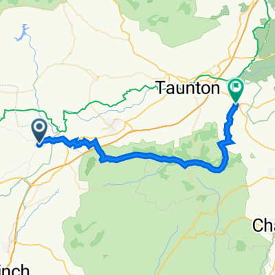
Overview
About this route
Tiverton Travelodge to Angel Inn, Long Ashton, via a more scenic but more hilly route (includes Cheddar Gorge)
- -:--
- Duration
- 115.5 km
- Distance
- 848 m
- Ascent
- 887 m
- Descent
- ---
- Avg. speed
- ---
- Max. altitude
Route quality
Waytypes & surfaces along the route
Waytypes
Road
42.2 km
(37 %)
Busy road
34.6 km
(30 %)
Surfaces
Paved
44.6 km
(39 %)
Asphalt
39.6 km
(34 %)
Paved (undefined)
5 km
(4 %)
Undefined
70.9 km
(61 %)
Continue with Bikemap
Use, edit, or download this cycling route
You would like to ride LEJOG stage 3 alt or customize it for your own trip? Here is what you can do with this Bikemap route:
Free features
- Save this route as favorite or in collections
- Copy & plan your own version of this route
- Split it into stages to create a multi-day tour
- Sync your route with Garmin or Wahoo
Premium features
Free trial for 3 days, or one-time payment. More about Bikemap Premium.
- Navigate this route on iOS & Android
- Export a GPX / KML file of this route
- Create your custom printout (try it for free)
- Download this route for offline navigation
Discover more Premium features.
Get Bikemap PremiumFrom our community
Other popular routes starting in Uffculme
 21 Higher Town, Tiverton to 113 Dragon Rise, Taunton
- Distance
- 30.4 km
- Ascent
- 229 m
- Descent
- 301 m
- Location
- Uffculme, England, United Kingdom
 LEJOG stage 3 alt
- Distance
- 115.5 km
- Ascent
- 848 m
- Descent
- 887 m
- Location
- Uffculme, England, United Kingdom
 LEJOG stage 3
- Distance
- 103.6 km
- Ascent
- 343 m
- Descent
- 380 m
- Location
- Uffculme, England, United Kingdom
 Blackdown Hills Day2
- Distance
- 43.5 km
- Ascent
- 452 m
- Descent
- 452 m
- Location
- Uffculme, England, United Kingdom
 Westleigh Loop
- Distance
- 11.8 km
- Ascent
- 74 m
- Descent
- 76 m
- Location
- Uffculme, England, United Kingdom
 Webbers PTFA Cycle Route
- Distance
- 15.2 km
- Ascent
- 176 m
- Descent
- 176 m
- Location
- Uffculme, England, United Kingdom
 Ashe Campsite
- Distance
- 33.9 km
- Ascent
- 479 m
- Descent
- 555 m
- Location
- Uffculme, England, United Kingdom
 ATOB Nello 2020
- Distance
- 99.1 km
- Ascent
- 790 m
- Descent
- 790 m
- Location
- Uffculme, England, United Kingdom
Open it in the app