

2008/8 7. Tag Tour de Jumelage Baunatal-Vire (Bernay-Vire)
A cycling route starting in Bernay, Normandy, France.
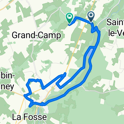
Overview
About this route
About 134 km left and we will reach our destination in Vire. The 7th and final stage takes us from Bernay through the hilly terrain of Normandy to Falais. The D511 then connects Falais with Pont d Ouilly. Through a small valley, Conde sur Noireau will be the gateway to Norman Switzerland. From here there are still 25 km left, which are quite challenging. Climbing and descending to Vire. Our destination is reached.
- -:--
- Duration
- 140.8 km
- Distance
- 1,248 m
- Ascent
- 1,237 m
- Descent
- ---
- Avg. speed
- 271 m
- Max. altitude
Route quality
Waytypes & surfaces along the route
Waytypes
Quiet road
18.3 km
(13 %)
Road
14.1 km
(10 %)
Surfaces
Paved
18.3 km
(13 %)
Asphalt
18.3 km
(13 %)
Undefined
122.5 km
(87 %)
Route highlights
Points of interest along the route
Point of interest after 133.9 km
Der letzte Anstieg
Point of interest after 140.8 km
Hotel
Point of interest after 140.8 km
Rathaus
Continue with Bikemap
Use, edit, or download this cycling route
You would like to ride 2008/8 7. Tag Tour de Jumelage Baunatal-Vire (Bernay-Vire) or customize it for your own trip? Here is what you can do with this Bikemap route:
Free features
- Save this route as favorite or in collections
- Copy & plan your own version of this route
- Split it into stages to create a multi-day tour
- Sync your route with Garmin or Wahoo
Premium features
Free trial for 3 days, or one-time payment. More about Bikemap Premium.
- Navigate this route on iOS & Android
- Export a GPX / KML file of this route
- Create your custom printout (try it for free)
- Download this route for offline navigation
Discover more Premium features.
Get Bikemap PremiumFrom our community
Other popular routes starting in Bernay
 Bernay Voie Verte
- Distance
- 25 km
- Ascent
- 93 m
- Descent
- 99 m
- Location
- Bernay, Normandy, France
 De Boulevard Dubus 43B, Bernay à Rue Leprévost de Beaumont 9, Bernay
- Distance
- 9.6 km
- Ascent
- 109 m
- Descent
- 102 m
- Location
- Bernay, Normandy, France
 Bernay - Le Mans
- Distance
- 174.3 km
- Ascent
- 507 m
- Descent
- 558 m
- Location
- Bernay, Normandy, France
 De Le Fay à La Panière
- Distance
- 23.5 km
- Ascent
- 161 m
- Descent
- 203 m
- Location
- Bernay, Normandy, France
 2 Chemin du Hamel, Treis-Sants-en-Ouche à 2 Chemin du Hamel, Treis-Sants-en-Ouche
- Distance
- 10 km
- Ascent
- 32 m
- Descent
- 34 m
- Location
- Bernay, Normandy, France
 2008/8 7. Tag Tour de Jumelage Baunatal-Vire (Bernay-Vire)
- Distance
- 140.8 km
- Ascent
- 1,248 m
- Descent
- 1,237 m
- Location
- Bernay, Normandy, France
 Bernay Orbec Broglie Bernay
- Distance
- 42.7 km
- Ascent
- 392 m
- Descent
- 392 m
- Location
- Bernay, Normandy, France
 Bernay-Deauville par Lisieux
- Distance
- 89.7 km
- Ascent
- 405 m
- Descent
- 516 m
- Location
- Bernay, Normandy, France
Open it in the app