

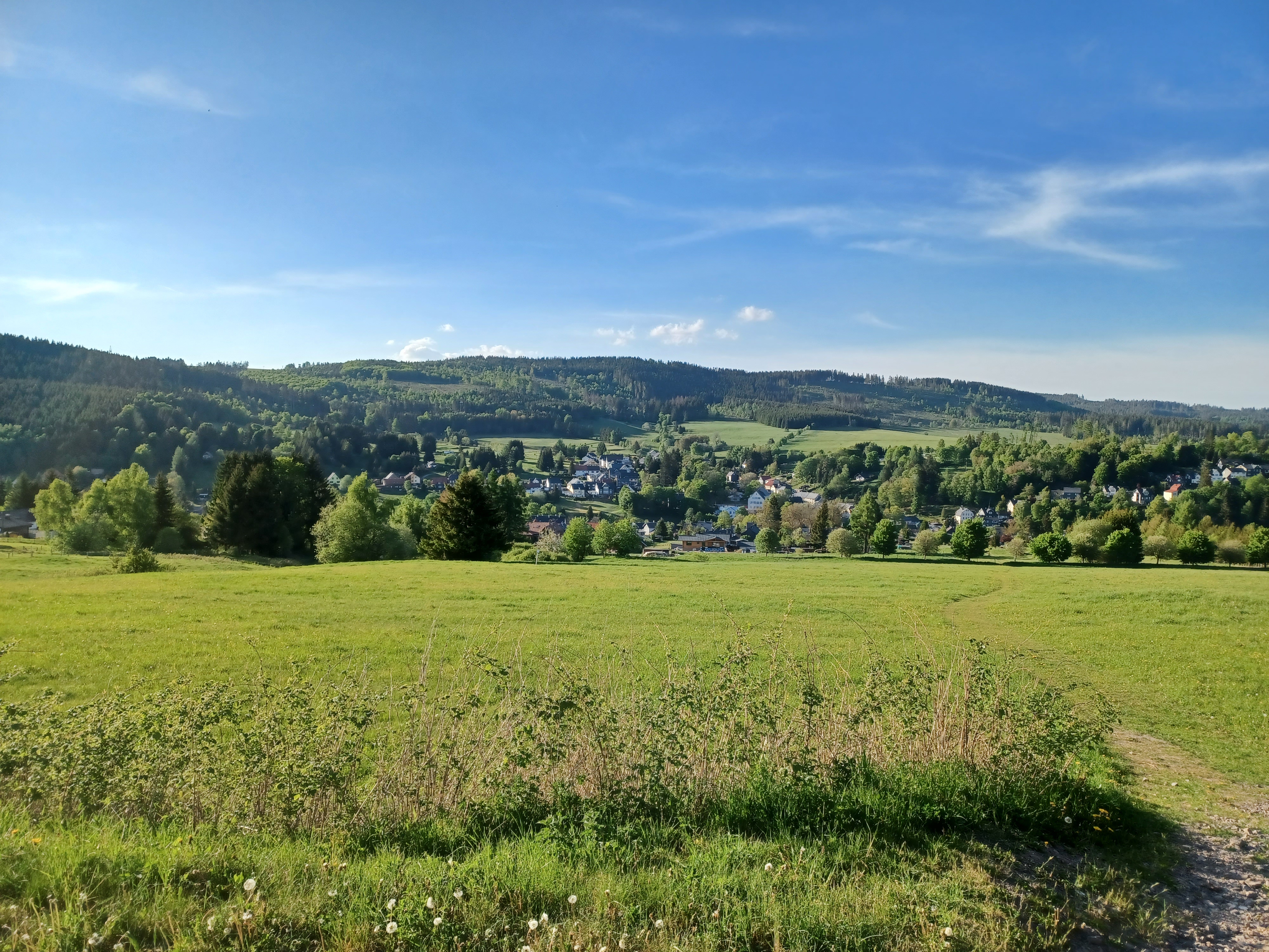
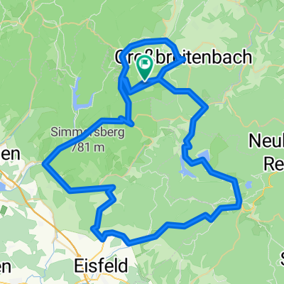
von Hirschbach nach Gießübel und zurück
A cycling route starting in Altenfeld, Thuringia, Germany.
Overview
About this route
Gießübel to Hirschbach
Stopwatch:
05:09:23
Route:
49.6 km
Calories:
2187 kcal
Average Speed:
11.4 km/h
Max Speed:
33.8 km/h
Elevation:
283 m
- -:--
- Duration
- 24.9 km
- Distance
- 189 m
- Ascent
- 288 m
- Descent
- ---
- Avg. speed
- ---
- Max. altitude

Continue with Bikemap
Use, edit, or download this cycling route
You would like to ride von Hirschbach nach Gießübel und zurück or customize it for your own trip? Here is what you can do with this Bikemap route:
Free features
- Save this route as favorite or in collections
- Copy & plan your own version of this route
- Sync your route with Garmin or Wahoo
Premium features
Free trial for 3 days, or one-time payment. More about Bikemap Premium.
- Navigate this route on iOS & Android
- Export a GPX / KML file of this route
- Create your custom printout (try it for free)
- Download this route for offline navigation
Discover more Premium features.
Get Bikemap PremiumFrom our community
Other popular routes starting in Altenfeld
 Profi Tour durch Thüringen
- Distance
- 152.5 km
- Ascent
- 1,667 m
- Descent
- 1,662 m
- Location
- Altenfeld, Thuringia, Germany
 Gießübler Straße 58, Großbreitenbach nach Gießübler Straße 58, Großbreitenbach
- Distance
- 7.1 km
- Ascent
- 153 m
- Descent
- 200 m
- Location
- Altenfeld, Thuringia, Germany
 von Hirschbach nach Gießübel und zurück
- Distance
- 24.9 km
- Ascent
- 189 m
- Descent
- 288 m
- Location
- Altenfeld, Thuringia, Germany
 Gießübler Straße 58, Großbreitenbach nach Goldbergstraße 14, Großbreitenbach
- Distance
- 49 km
- Ascent
- 618 m
- Descent
- 665 m
- Location
- Altenfeld, Thuringia, Germany
 Goldbergstraße 12, Großbreitenbach nach Goldbergstraße 12, Großbreitenbach
- Distance
- 11 km
- Ascent
- 238 m
- Descent
- 238 m
- Location
- Altenfeld, Thuringia, Germany
 Goldbergstraße 12, Großbreitenbach nach Goldbergstraße 12, Großbreitenbach
- Distance
- 5.6 km
- Ascent
- 117 m
- Descent
- 117 m
- Location
- Altenfeld, Thuringia, Germany
 Rundfahrt durch Südthüringen
- Distance
- 79.3 km
- Ascent
- 1,523 m
- Descent
- 1,541 m
- Location
- Altenfeld, Thuringia, Germany
 2016-07-03: Rennsteig - Werratal - Werraquelle
- Distance
- 67 km
- Ascent
- 782 m
- Descent
- 781 m
- Location
- Altenfeld, Thuringia, Germany
Open it in the app