
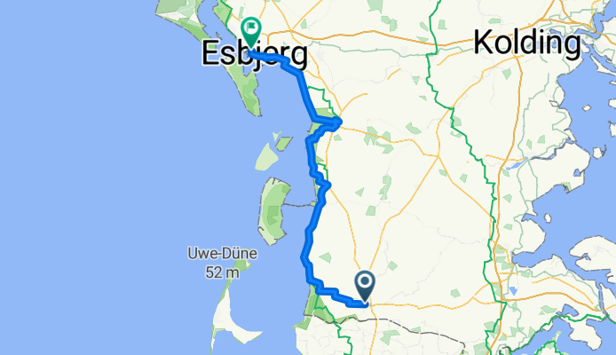
Rund um Jütland, Etappe 1: Tondern-Ribe-Esbjerg
A cycling route starting in Tønder, Region South Denmark, Denmark.
Overview
About this route
Nordseeküsten-Radweg
- -:--
- Duration
- 105.5 km
- Distance
- 55 m
- Ascent
- 50 m
- Descent
- ---
- Avg. speed
- ---
- Avg. speed
Route quality
Waytypes & surfaces along the route
Waytypes
Quiet road
41.1 km
(39 %)
Road
14.3 km
(14 %)
Surfaces
Paved
78.6 km
(74 %)
Unpaved
16.7 km
(16 %)
Asphalt
76.2 km
(72 %)
Gravel
15.7 km
(15 %)
Continue with Bikemap
Use, edit, or download this cycling route
You would like to ride Rund um Jütland, Etappe 1: Tondern-Ribe-Esbjerg or customize it for your own trip? Here is what you can do with this Bikemap route:
Free features
- Save this route as favorite or in collections
- Copy & plan your own version of this route
- Split it into stages to create a multi-day tour
- Sync your route with Garmin or Wahoo
Premium features
Free trial for 3 days, or one-time payment. More about Bikemap Premium.
- Navigate this route on iOS & Android
- Export a GPX / KML file of this route
- Create your custom printout (try it for free)
- Download this route for offline navigation
Discover more Premium features.
Get Bikemap PremiumFrom our community
Other popular routes starting in Tønder
 Danemark
- Distance
- 698.2 km
- Ascent
- 488 m
- Descent
- 484 m
- Location
- Tønder, Region South Denmark, Denmark
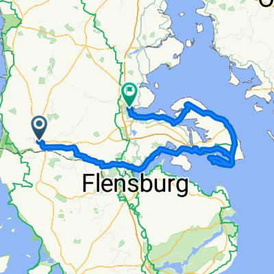 Tønder to Åbenrå
- Distance
- 180.5 km
- Ascent
- 855 m
- Descent
- 848 m
- Location
- Tønder, Region South Denmark, Denmark
 Vestkystruten
- Distance
- 563.5 km
- Ascent
- 1,002 m
- Descent
- 1,003 m
- Location
- Tønder, Region South Denmark, Denmark
 Tyskegrensa (Tønder) til den franske grensa (Quevrechain), 902km
- Distance
- 902.6 km
- Ascent
- 353 m
- Descent
- 317 m
- Location
- Tønder, Region South Denmark, Denmark
 Danemark
- Distance
- 518.7 km
- Ascent
- 760 m
- Descent
- 761 m
- Location
- Tønder, Region South Denmark, Denmark
 Koldin Niebul
- Distance
- 85.6 km
- Ascent
- 19 m
- Descent
- 18 m
- Location
- Tønder, Region South Denmark, Denmark
 From Højer to Åbenrå
- Distance
- 113.7 km
- Ascent
- 397 m
- Descent
- 370 m
- Location
- Tønder, Region South Denmark, Denmark
 Lægan to Vadehavscentret
- Distance
- 56.9 km
- Ascent
- 61 m
- Descent
- 65 m
- Location
- Tønder, Region South Denmark, Denmark
Open it in the app