

rando g matagne 2012 /25km
A cycling route starting in Drocourt, Hauts-de-France, France.
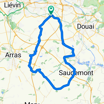
Overview
About this route
- -:--
- Duration
- 23.7 km
- Distance
- 88 m
- Ascent
- 88 m
- Descent
- ---
- Avg. speed
- ---
- Max. altitude
Route highlights
Points of interest along the route
Point of interest after 10.2 km
ravito
Point of interest after 23.7 km
départ et arrivée :espace agora
Continue with Bikemap
Use, edit, or download this cycling route
You would like to ride rando g matagne 2012 /25km or customize it for your own trip? Here is what you can do with this Bikemap route:
Free features
- Save this route as favorite or in collections
- Copy & plan your own version of this route
- Sync your route with Garmin or Wahoo
Premium features
Free trial for 3 days, or one-time payment. More about Bikemap Premium.
- Navigate this route on iOS & Android
- Export a GPX / KML file of this route
- Create your custom printout (try it for free)
- Download this route for offline navigation
Discover more Premium features.
Get Bikemap PremiumFrom our community
Other popular routes starting in Drocourt
 rando g matagne 45km route
- Distance
- 45 km
- Ascent
- 175 m
- Descent
- 173 m
- Location
- Drocourt, Hauts-de-France, France
 parcours g matagne route 84km
- Distance
- 83.3 km
- Ascent
- 230 m
- Descent
- 230 m
- Location
- Drocourt, Hauts-de-France, France
 67 km g matagne 2014 route
- Distance
- 66.7 km
- Ascent
- 235 m
- Descent
- 235 m
- Location
- Drocourt, Hauts-de-France, France
 droàcourtoise vtt 2018
- Distance
- 50.4 km
- Ascent
- 102 m
- Descent
- 105 m
- Location
- Drocourt, Hauts-de-France, France
 rando familles velo + pedestre :val de souchez + terril pinchonvales
- Distance
- 12.8 km
- Ascent
- 114 m
- Descent
- 55 m
- Location
- Drocourt, Hauts-de-France, France
 rando g matagne 2012 /25km
- Distance
- 23.7 km
- Ascent
- 88 m
- Descent
- 88 m
- Location
- Drocourt, Hauts-de-France, France
 vtt g matagne 2014 (n1)
- Distance
- 50.6 km
- Ascent
- 196 m
- Descent
- 195 m
- Location
- Drocourt, Hauts-de-France, France
 65 km par vis en artois
- Distance
- 65.2 km
- Ascent
- 250 m
- Descent
- 247 m
- Location
- Drocourt, Hauts-de-France, France
Open it in the app