

LEJOG stage 4 (scenic)
A cycling route starting in Long Ashton, England, United Kingdom.
Overview
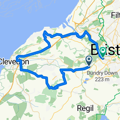
About this route
Long Ashton to Kington, scenic but hilly route
- -:--
- Duration
- 126.7 km
- Distance
- 844 m
- Ascent
- 710 m
- Descent
- ---
- Avg. speed
- ---
- Max. altitude
Route quality
Waytypes & surfaces along the route
Waytypes
Road
20.3 km
(16 %)
Quiet road
20.3 km
(16 %)
Surfaces
Paved
77.3 km
(61 %)
Asphalt
77.3 km
(61 %)
Undefined
49.4 km
(39 %)
Continue with Bikemap
Use, edit, or download this cycling route
You would like to ride LEJOG stage 4 (scenic) or customize it for your own trip? Here is what you can do with this Bikemap route:
Free features
- Save this route as favorite or in collections
- Copy & plan your own version of this route
- Split it into stages to create a multi-day tour
- Sync your route with Garmin or Wahoo
Premium features
Free trial for 3 days, or one-time payment. More about Bikemap Premium.
- Navigate this route on iOS & Android
- Export a GPX / KML file of this route
- Create your custom printout (try it for free)
- Download this route for offline navigation
Discover more Premium features.
Get Bikemap PremiumFrom our community
Other popular routes starting in Long Ashton
 Bluebell - a tramp in the woods
- Distance
- 5.9 km
- Ascent
- 84 m
- Descent
- 86 m
- Location
- Long Ashton, England, United Kingdom
 Easy ride in Bristol
- Distance
- 8.5 km
- Ascent
- 0 m
- Descent
- 5 m
- Location
- Long Ashton, England, United Kingdom
 Three Peaks challenge
- Distance
- 13.9 km
- Ascent
- 383 m
- Descent
- 247 m
- Location
- Long Ashton, England, United Kingdom
 40 miler
- Distance
- 70.1 km
- Ascent
- 631 m
- Descent
- 633 m
- Location
- Long Ashton, England, United Kingdom
 Chew valley short
- Distance
- 33.2 km
- Ascent
- 297 m
- Descent
- 305 m
- Location
- Long Ashton, England, United Kingdom
 Long Ashton Road 83 to Cheddar Valley Railway Walk
- Distance
- 24.1 km
- Ascent
- 82 m
- Descent
- 174 m
- Location
- Long Ashton, England, United Kingdom
 Clevedon loop, 30m
- Distance
- 49.8 km
- Ascent
- 507 m
- Descent
- 519 m
- Location
- Long Ashton, England, United Kingdom
 Three Peaks; ...another 6 miles ? (+ 600ft up)
- Distance
- 11.4 km
- Ascent
- 204 m
- Descent
- 233 m
- Location
- Long Ashton, England, United Kingdom
Open it in the app