Circuito de la Calesita
A cycling route starting in Mendoza, Mendoza Province, Argentina.
Overview
About this route
Training circuit
- -:--
- Duration
- 4.8 km
- Distance
- 47 m
- Ascent
- 50 m
- Descent
- ---
- Avg. speed
- ---
- Max. altitude
Route quality
Waytypes & surfaces along the route
Waytypes
Quiet road
2.6 km
(55 %)
Road
1.6 km
(34 %)
Surfaces
Paved
4.2 km
(88 %)
Asphalt
3.1 km
(65 %)
Concrete
1.1 km
(23 %)
Undefined
0.6 km
(12 %)
Continue with Bikemap
Use, edit, or download this cycling route
You would like to ride Circuito de la Calesita or customize it for your own trip? Here is what you can do with this Bikemap route:
Free features
- Save this route as favorite or in collections
- Copy & plan your own version of this route
- Sync your route with Garmin or Wahoo
Premium features
Free trial for 3 days, or one-time payment. More about Bikemap Premium.
- Navigate this route on iOS & Android
- Export a GPX / KML file of this route
- Create your custom printout (try it for free)
- Download this route for offline navigation
Discover more Premium features.
Get Bikemap PremiumFrom our community
Other popular routes starting in Mendoza
Mendoza - Santiago - La Serena- Distance
- 947.4 km
- Ascent
- 4,507 m
- Descent
- 5,267 m
- Location
- Mendoza, Mendoza Province, Argentina
mendosa a vina del mar- Distance
- 414.5 km
- Ascent
- 2,981 m
- Descent
- 3,711 m
- Location
- Mendoza, Mendoza Province, Argentina
GRAN DESAFIO A LOS SENDEROS. Como llegar a la largada del Enduro MTB- Distance
- 9.8 km
- Ascent
- 501 m
- Descent
- 0 m
- Location
- Mendoza, Mendoza Province, Argentina
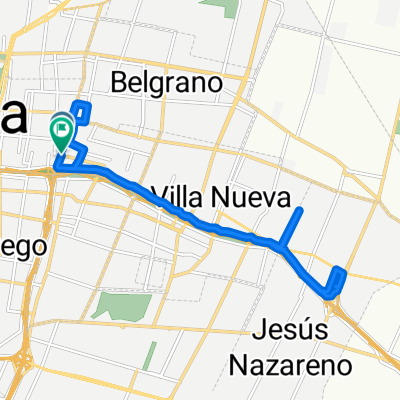
De Avenida Mitre a Avenida Mitre- Distance
- 15.1 km
- Ascent
- 177 m
- Descent
- 200 m
- Location
- Mendoza, Mendoza Province, Argentina
Frias - Chacras- Distance
- 30.9 km
- Ascent
- 486 m
- Descent
- 289 m
- Location
- Mendoza, Mendoza Province, Argentina
ADVENTURE RUNNING 25KM - 15 JUNIO- Distance
- 24.6 km
- Ascent
- 396 m
- Descent
- 468 m
- Location
- Mendoza, Mendoza Province, Argentina
5º Gran Desafío a los Senderos. 23 de SEPTIEMBRE 2012 CLONED FROM ROUTE 562583- Distance
- 35.8 km
- Ascent
- 670 m
- Descent
- 670 m
- Location
- Mendoza, Mendoza Province, Argentina
Cruce de los Andes por Cristo Redentor- Distance
- 363 km
- Ascent
- 3,586 m
- Descent
- 3,782 m
- Location
- Mendoza, Mendoza Province, Argentina
Open it in the app


