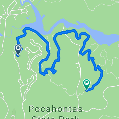
Pocahontas ride 1st day
A cycling route starting in Chesterfield, Virginia, United States of America.
Overview
About this route
Ride to be tried and we will comment after / parcours a essayer et nous le commentrons ensuite.
- -:--
- Duration
- 117.2 km
- Distance
- 308 m
- Ascent
- 309 m
- Descent
- ---
- Avg. speed
- ---
- Avg. speed
Route quality
Waytypes & surfaces along the route
Waytypes
Busy road
73.8 km
(63 %)
Road
24.7 km
(21 %)
Surfaces
Paved
3 km
(3 %)
Unpaved
0.1 km
(<1 %)
Asphalt
1.4 km
(1 %)
Paved (undefined)
1.2 km
(1 %)
Continue with Bikemap
Use, edit, or download this cycling route
You would like to ride Pocahontas ride 1st day or customize it for your own trip? Here is what you can do with this Bikemap route:
Free features
- Save this route as favorite or in collections
- Copy & plan your own version of this route
- Sync your route with Garmin or Wahoo
Premium features
Free trial for 3 days, or one-time payment. More about Bikemap Premium.
- Navigate this route on iOS & Android
- Export a GPX / KML file of this route
- Create your custom printout (try it for free)
- Download this route for offline navigation
Discover more Premium features.
Get Bikemap PremiumFrom our community
Other popular routes starting in Chesterfield
- Nash Road 11318, Chesterfield to Pams Way 14629, Bakersfield
- Distance
- 5,228.4 km
- Ascent
- 42,344 m
- Descent
- 42,293 m
- Location
- Chesterfield, Virginia, United States of America
- Steady ride in Chesterfield
- Distance
- 21.4 km
- Ascent
- 196 m
- Descent
- 205 m
- Location
- Chesterfield, Virginia, United States of America
- Long Forest Trail, Chesterfield a Long Forest Trail, Chesterfield
- Distance
- 11 km
- Ascent
- 119 m
- Descent
- 126 m
- Location
- Chesterfield, Virginia, United States of America
- Route to 4255 Old River Trail, Powhatan
- Distance
- 57.2 km
- Ascent
- 251 m
- Descent
- 231 m
- Location
- Chesterfield, Virginia, United States of America
- Pocahontas ride 1st day
- Distance
- 117.2 km
- Ascent
- 308 m
- Descent
- 309 m
- Location
- Chesterfield, Virginia, United States of America
- Long Forest Trail, Chesterfield a Long Forest Trail, Chesterfield
- Distance
- 6.3 km
- Ascent
- 82 m
- Descent
- 90 m
- Location
- Chesterfield, Virginia, United States of America
- Moderate route in Chesterfield
- Distance
- 10.4 km
- Ascent
- 164 m
- Descent
- 152 m
- Location
- Chesterfield, Virginia, United States of America
- Easy ride in Chesterfield
- Distance
- 16.3 km
- Ascent
- 0 m
- Descent
- 13 m
- Location
- Chesterfield, Virginia, United States of America
Open it in the app